Lake Superior Coastal Drive
Top stops along the North Shore of Lake Superior
Lake Superior's rugged North Shore, from Sault Ste. Marie to Thunder Bay, offers one of the most scenic drives in the country.
By surface area, Lake Superior is the largest lake in the world; the largest of the five Great Lakes by far.
The Anishinaabe, who have lived along these shores for millennia, call the lake gichigamiing. It means big lake or big waters.
It's coastline is also the least developed of all the Great Lakes, making it an incredible area for exploration, whether on foot along the many hiking paths located on the shore or by paddle along ancient canoe routes.
Sleeping Giant Provincial Park. Photo by Ontario Parks
Sleeping Giant Provincial Park. Photo by Ontario Parks
The drive from Sault Ste. Marie to Thunder Bay has been described as one of the most scenic road trips in Canada. Follow the path below and discover some of the alluring stops along the way.
Sault Ste. Marie
Photo by Destination Ontario
Photo by Destination Ontario
Begin your Lake Superior road trip in Sault Ste. Marie, which sits on St. Mary's River at the spot where Lake Huron and Lake Superior meet.
Affectionately known as the Soo, the city grew up on the original meeting grounds of the Batchewana and Anishinabek people.
If you love nature, you'll find plenty of things to do in the Soo, from hiking and biking to swimming and more.
The Agawa Canyon Train leaves from Sault Ste. Marie from August until mid-October (reservations highly recommended as it fills up quickly especially during the fall colours season).
For a water-based adventure, try the Miss Marie Sault Locks Tour, which is a boat trip that takes passengers through the locks on both the Canadian and American sides (passport not required). These locks connect Lake Superior to the lower Great Lakes and are a vital component of the St. Lawrence Seaway.
Pancake Bay Provincial Park
Photo Ontario Parks
Photo Ontario Parks
Take in panoramic views of Lake Superior from Pancake Bay Provincial Park.
The wide, sandy beach stretches for 3 km, with plenty of room to spread out and enjoy the views. The park is narrow and set alongside the Trans Canada highway, so expect some traffic noise if you choose to camp here.
The water is a spectacular colour, but don't be fooled by the tropical tones — like all of Lake Superior, the temperature of the water is deceptively cold. It makes for a refreshing dip on a hot summer day.
Photo Ontario Parks
Photo Ontario Parks
Hikers of all levels can take on the 3.5 km Pancake Bay Nature Trail, which starts alongside the dramatic Lake Superior shoreline, but then takes you through varied terrain. Experience forested ancient beach ridges, wetlands and a meandering creek.
More advanced hikers (or those with more time) can try the Lookout Trail, which leads — you guessed it — to a lookout over Lake Superior where you can see across to Whitefish Point. According to Ontario Parks, this is the stretch of Lake Superior known as the graveyard of the Great Lakes (where the Edmund Fitzgerald sank in a fierce storm in 1975).
Photo Ontario Parks
Photo Ontario Parks
*Note: About 10 minutes before you reach Pancake Bay Provincial Park, you'll pass Batchawana Bay Provincial Park. This park is day-use only (no overnight camping) but also has a gorgeous beach and beautiful views over Lake Superior. It is worth a stop if you have time and it makes for a great picnic spot.
Lake Superior Provincial Park
Photo Ontario Parks
Photo Ontario Parks
This stretch of the lake's shoreline, where the spectacular Lake Superior Provincial Park sits, is characterized by cliffs, river valleys, beaches, waterfalls and inland lakes. You could spend weeks exploring this diverse landscape.
Photo by Ontario Parks
Photo by Ontario Parks
There are eight canoe routes in the park, ranging in difficulty from fun day trips to multi-day adventures.
Of the eleven hiking routes in the park, the most famous is probably the Agawa Rock Pictographs. This hike is short but treacherous and should only be attempted when the lake is calm. It leads to a rock ledge at the edge of Lake Superior where you can see 35 Indigenous pictographs.
The pictographs are a sacred site for the Ojibwe, whose ancestors used red ochre to record these ancient messages.
Ontario Parks advises caution for anyone attempting this trail due to the unpredictable nature of Lake Superior.
Wawa
Photo at Destination Ontario
Photo at Destination Ontario
Wawa is the Ojibwe word for wild goose, which shouldn't come as a surprise to anyone who has visited this community. Travellers are greeted to the town by a towering statue of a Canada Goose.
Wawa is just 20 minutes from Lake Superior Provincial Park and is a great spot to stop.
White Lake Provincial Park
Photo Ontario Parks
Photo Ontario Parks
If you're looking for a warm lake in which to swim, you'll find it at White Lake Provincial Park.
In addition to a sandy beach with warm waters for swimming, the park also offers nature trails and excellent fishing (particularly for walleye and Northern Pike).
Photo Ontario Parks
Photo Ontario Parks
Pukaskwa National Park
Canoeing in Hattie Cove at sunrise. Photo by Parks Canada/Scott Munn
Canoeing in Hattie Cove at sunrise. Photo by Parks Canada/Scott Munn
Pukaskwa National Park is tucked in near the town of Marathon. To reach it, you’ll have to get off the Trans-Canada Highway and go south on Hwy 627.
At the end of the road is the entrance to Pukaskwa’s one and only front country campground (Hattie Cove) and there are no roads past this campground. If you want to explore further, you’ll have to go by foot or paddle. Due to its lack of roads, this entire part of the Lake Superior is still wild — the largest stretch of undeveloped shoreline anywhere in the Great Lakes region.
The biggest attraction at Pukaskwa is the hiking. Whether you’re looking for a scenic walk, a full-day challenge or an intense multi-day trek, Pukaskwa has you covered.
Pukaskwa National Park. Photo by Destination Ontario
Pukaskwa National Park. Photo by Destination Ontario
There are two small walks at Pukaskwa that can easily be tackled by most visitors to the park — the accessible Boardwalk Beach Trail, which is a 1.2 km walk to Horseshoe Bay (come in the evening for a killer sunset view!) and the Hattie Cove Fire Walk, a 700-metre stroll through the 2012 prescribed fire zone (cool to see the regeneration that takes place so quickly in the boreal forest).
Those looking for a more challenging trail can try what is perhaps the most well-known of Pukaskwa’s hikes: the White River Suspension Bridge Trail. As its name suggests, this trail crosses a suspension bridge — a spectacular one in fact that hangs 23 metres above Chigamiwinigum Falls. The hike is an 18-kilometre full-day trek over varied terrain.
Neys Provincial Park
Photo Ontario Parks/Laura Myers
Photo Ontario Parks/Laura Myers
Did you know that before Neys became a provincial park it was a prisoner of war camp? Known as Neys Camp 100, the location housed German POWs from 1941 to 1946. The prisoner camp was dismantled in the 1950s but today's leisure campers can still see remnants of this history in the Visitor Centre.
Photo Ontario Parks
Photo Ontario Parks
Neys is also home to Little Pic River and Pic Island, both fun areas for paddlers to explore. The park offers many hiking trails — while most are short in distance, they vary in difficult depending on the terrain.
Those looking to enjoy the beach will love Neys for its two kilometres of fine-sand beach. Come for a refreshing dip or just to enjoy the view of crashing waves. It is a perfect spot from which to enjoy a Lake Superior sunset.
Lake Superior National Marine
Conservation Area
Photo by Northern Soul
Photo by Northern Soul
Headquartered in Nipigon, the Lake Superior National Marine Conservation Area protects approximately 10,000 sq km, making it the largest protected area of freshwater in the world.
Photo by Northern Soul
Photo by Northern Soul
It extends along the north shore of the lake from Thunder Cape at the tip of Sleeping Giant Provincial Park in the west to Bottle Point, just east of Terrace Bay, and all the way to the Canada-US border. It includes the waters of Black Bay and Nipigon Bay, as well as numerous islands.
Take an in-depth look at the area in our article titled Secrets of the Inland Sea.
Ouimet Canyon Provincial Park
Photo Ontario Parks
Photo Ontario Parks
A slight detour off the main road will bring you to the Ouimet Canyon Provincial Park. This day use park has just one trail but it leads to a spectacular sight: the 100-metre high Ouimet Canyon.
At 150-metres wide, with straight views to the bottom, Ouimet Canyon is a worthwhile stop. From the parking lot, it is a short walk along a one kilometre loop to two platforms with spectacular views.
Photo Ontario Parks
Photo Ontario Parks
The canyon is a great spot for birdwatching. A variety if birds can be seen here seasonally, including Peregrine Falcons, which likes to nests on these cliffs.
Photo Ontario Parks
Photo Ontario Parks
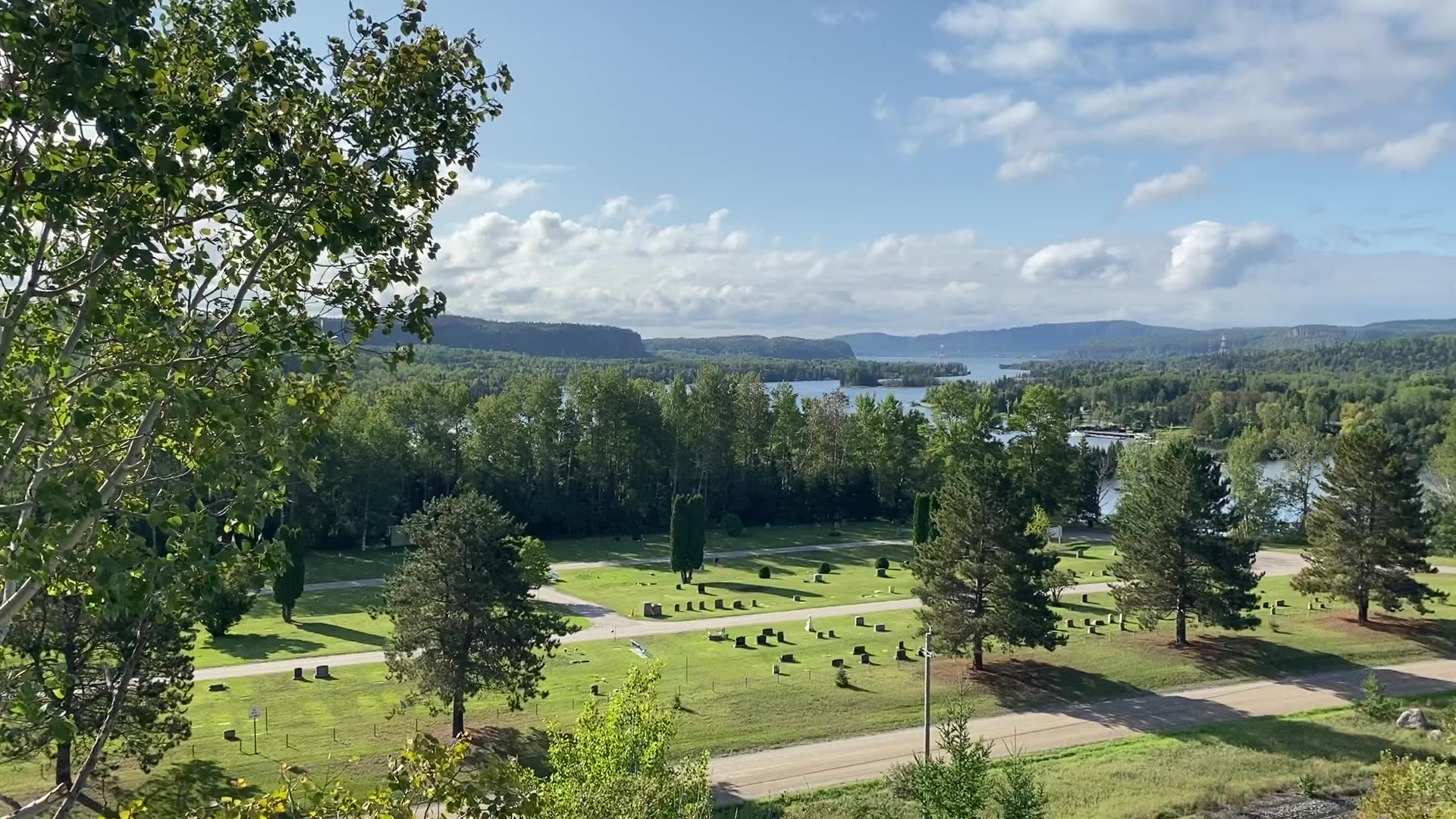
Sleeping Giant Provincial Park
Photo by Destination Ontario
Photo by Destination Ontario
The Sleeping Giant Provincial Park occupies most of the Sibley Peninsula, a 52-kilometre long and 10-kilometre wide land mass that juts out into Lake Superior.
It's namesake, the Sleeping Giant, is a rock formation on the southern tip of the peninsula, that resembles a sleeping person from certain angles and has long become a symbol of Thunder Bay and the surrounding areas.
Photo by Destination Ontario
Photo by Destination Ontario
The parks most famous landmark can be climbed via the Top of the Giant Trail. From the parking lot, it is a 21.8 km round trip. At the top, hikers are rewarded with spectacular views of both the east and west coast of the Sibley Peninsula.
If you're not up for such a long hike but still want to climb the Giant, Sail Superior offers boat trips from Thunder Bay to the base of the Giant. From there, it is possible to climb up to the top while avoiding the lengthy part of the hike.
Photo Ontario Parks
Photo Ontario Parks
Hiking is a big part of the draw of Sleeping Giant, where there are 100 km of trails to be discovered. Cycling, paddling and fishing are also popular park activities.
Swimmers can head to the public beach on Marie Lousie Lake or to Pounsford Lake.
Thunder Bay
The largest Canadian city on Lake Superior is Thunder Bay. It offers all the city amenities you might need while being close to the nature trails and outdoor activities.
A visit to the nearby Terry Fox National Historic Monument is a must. This monument commemorates the journey taken by Canadian athlete Terry Fox in 1980-81. Despite having lost one leg to cancer, Terry set off on a Marathon of Hope across Canada to raise money and awareness for cancer. He ran more than 5,000 kilometres (nearly a marathon a day) for 143 straight days before he was forced to stop when his cancer returned. The monument marks the spot where his journey ended.
For more ideas of things to do in Thunder Bay, watch this video created by the Culinary Tourism Alliance:
Kakabeka Falls
Photo Ontario Parks
Photo Ontario Parks
Billed as the 'Niagara of the North', Kakabeka Falls is the second highest waterfall in Ontario. The 40 metres waterfall is formed by the Kaministiquia River as it flows on its journey from Dog Lake to Lake Superior.
Photo Ontario Parks
Photo Ontario Parks
Located less than 30 minutes from Thunder Bay, the falls are easily accessible from the park's parking lot via the Boardwalk Trail. Viewing platforms provide excellent views of the falls on both sides.
Photo Ontario Parks
Photo Ontario Parks
Quetico Provincial Park
Photo Ontario Parks
Photo Ontario Parks
An iconic wilderness park, Quetico is known for its rugged beauty and untouched landscapes. If you take the time to visit here, you won't leave disappointed.
Be prepared for a landscape of waterfalls and picturesque lakes, forests of spruce and pine, winding lakes and towering cliffs.
Photo Ontario Parks
Photo Ontario Parks
Quetico is recognized as an International Dark Sky Park so it is recommended to stay at least a few nights inside the park to get the full night-sky experience.
Facilities are available for car camping (front country) and the park is a great family camping spot. For those more adventurous campers, Quetico is famous for its backcountry canoeing, with more than 2,000 lakes and nearly half a million hectares of remote wilderness.
While this park is not on the North Shore of Lake Superior, we've included it here because it is such a worthwhile destination if you are in the vicinity.