National Treasures: A Look At Canada’s Natural UNESCO Heritage Sites
Waterton Lakes National Park. Photo by Mike Seehagel/Travel Alberta
Canada’s stunning landscape is studded with some of the most spectacular scenery in the world. Ten sites across Canada are recognized by UNESCO (the United Nations Educational, Scientific and Cultural Organization) as having outstanding universal value. We couldn’t agree more!
Take a look below at some of the amazing places that have been included on this list. Be sure to also read our blog post on the 10 UNESCO World Heritage Sites in Canada that have a cultural value designation (one of which has a mixed designation as it is also ecologically significant).
Nahanni National Park Reserve
Nahanni National Park Reserve. Photo by: Hans Pfaff/NWT Tourism
Where is Nahanni National Park Reserve?
To get to Nahanni National Park Reserve (Nahʔą Dehé) you’re going to have to travel north to the stunning wilds of the Northwest Territories. The park is located in the southwest corner of the territory. Getting here isn’t easy — there are no roads so you either have to fly in or hike in — but those that make the journey will get a glimpse of a landscape that almost defies belief.
Why is Nahanni National Park Reserve a UNESCO site?
In 1978, Nahanni was named one of the original 12 World Heritage Sites by UNESCO (along with L’Anse Aux Meadows in Newfoundland). In 2009, the borders of the protected park were expanded and now cover more than 30,000 square km of sub arctic terrain that spans three major ecozones: the Taiga Cordillera, the Taiga Plains and the Boreal Cordillera.
The landscape is one of contrasts, characterized by towering mountains and tundra plains, wetlands and sand dunes, badlands and lush forests. Hundreds of species of wildlife call this wild place home, including grizzly bears and northern mountain caribou. It is the homeland of the Dehcho First Nations, who work together with Parks Canada on park management.
And the centrepiece of the park is the powerful South Nahanni River, which flows through canyons that are 1,000-metres deep and produces huge waterfalls, swirling rapids and showstopping whirlpools. It is one of the most spectacular wild rivers on the continent and a bucket-list destination for many paddlers.
Can I visit Nahanni National Park Reserve?
The park office for the park is located in Fort Simpson, a small community in the Northwest Territories. It is the closest settlement to the vast park but from here, there are no roads into the interior. Visitors can either charter a floatplane from here or from Yellowknife or book a guided excursion. River paddling, alpine hiking and flightseeing are all popular.
Dinosaur Provincial Park
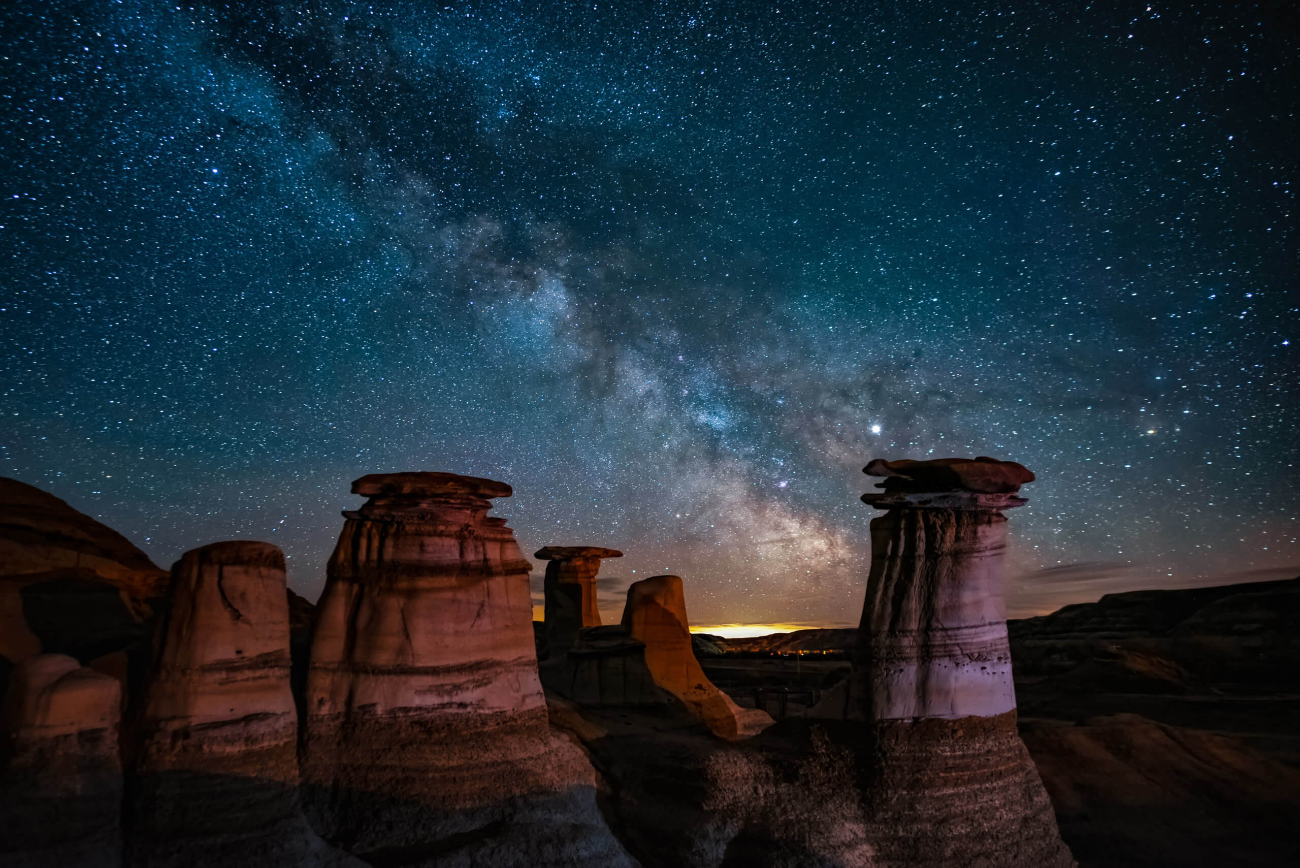
Dinosaur PP. Photo by Mark Jinx
Where is Dinosaur Provincial Park?
Dinosaur Provincial Park is located in the badlands topography of Alberta’s Red Deer River valley, approximately two hours east of Calgary.
Why is Dinosaur Provincial Park a UNESCO Heritage site?
As its name implies, Dinosaur Provincial Park is famous for its abundance of dinosaur fossils. In fact, the area contains the greatest concentration of Late Cretaceous dinosaur fossils in the world. More than 300 dinosaur skeletons have been recovered from a 27-km area along the Red Deer River since the 1880s. Many of the treasures recovered from the park can be viewed at the Royal Tyrrell Museum of Paleantology in Drumheller, about two hours northwest of the park.
Is a visit to Dinosaur Provincial Park worth it?
If you love geology and find dinosaurs fascinating, you’ll love visiting Dinosaur Provincial Park. The family programs and guided hikes make this a fun experience for kids and adults alike. Explore the outdoor interpretive fossil displays, climb the hoodoos in search of fossils (but do not remove any fossils, plants or rocks!), or camp by the river under the shade of cottonwood trees.
Kluane/Wrangell-St.Elias/Glacier Bay/Tatshenshini Alsek
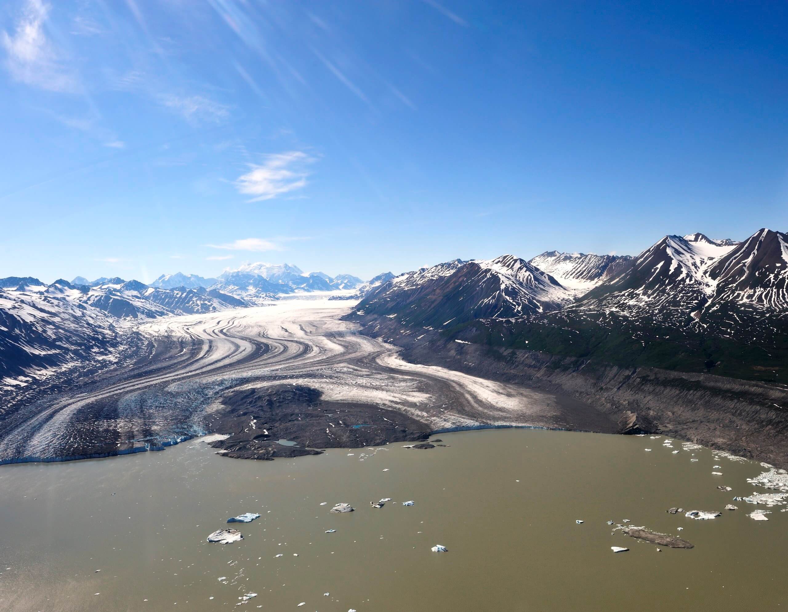
aerial view, Kluane National Park, flightseeing
Where is Kluane/Wrangell-St.Elias/Glacier Bay/Tatshenshini Alsek and why does it have so many names?
What a mouthful! This UNESCO World Heritage Site is actually a vast international preserve — thus all the different names! It is made up of Kluane National Park in the Yukon, Tatshenshini Alsek Provincial Park in northern British Columbia and the Wrangell-St. Elias National Park and Glacier Bay National Park in the United States.
Why is Kluane/Wrangell-St.Elias/Glacier Bay/Tatshenshini Alsek a UNESCO site?
This site is a 97,000 square km unbroken ecological unit that houses the St. Elias Mountains, which have the largest grouping of great peaks in North America. Within this group is Mount Logan, the highest mountain in Canada at 5,959 metres. What makes this vast wilderness so ecologically important is that it contains the world’s largest non-polar icefield and some of the world’s longest and most spectacular glaciers. The landscape is home to a wide variety of wildlife, including grizzly bears, caribou and Dall’s sheep.
How can I explore Kluane/Wrangell-St.Elias/Glacier Bay/Tatshenshini Alsek?
On the Canadian side of this massive Heritage Site, are two beautiful parks that can be explored by adventurers. Kluane National Park is located in the southwest corner of the Yukon, about 160 km from Whitehorse, and offers year-round access to activities. Read our hiking guide to Kluane for some inspiration. Situated in the northwest corner of British Columbia, between the glacial giants of the Yukon and Alaska, is the Tatshenshini-Alsek Park — a place of wild beauty that attracts kayakers and rafters to its two magnificent river systems.
Wood Buffalo National Park

Photo by Nick Firzhardinge/Travel Alberta
Where is Wood Buffalo National Park?
Wood Buffalo National Park straddles the border between Alberta and the Northwest Territories. It is the largest national park in Canada and one of the largest in the world.
Why is Wood Buffalo a UNESCO site?
As its name suggests, Wood Buffalo National Park is home to North America’s largest population of wild bison — a species that is on the threatened list. But it is also significant for other unique features: its large tracts of undisturbed boreal forest provides a crucial habitat for many species, it is the only nesting place of the endangered whooping crane, hold’s the world’s largest inland delta and is the world’s largest dark sky preserve. UNESCO recognized this stunning place as an “outstanding example of ongoing ecological and biological processes encompassing some of the largest undisturbed grass and sedge meadows left in North America.”
Encompassing 4.5 million hectares, the park allows for the protection of entire ecosystems.
Can I visit Wood Buffalo National Park?
Although remote, Wood Buffalo National Park is accessible to those who wish to explore its wilderness. There are camping options within the park and year-round activities, including hiking, paddling, snowshoeing, fishing and boating.
Canadian Rocky Mountain Parks
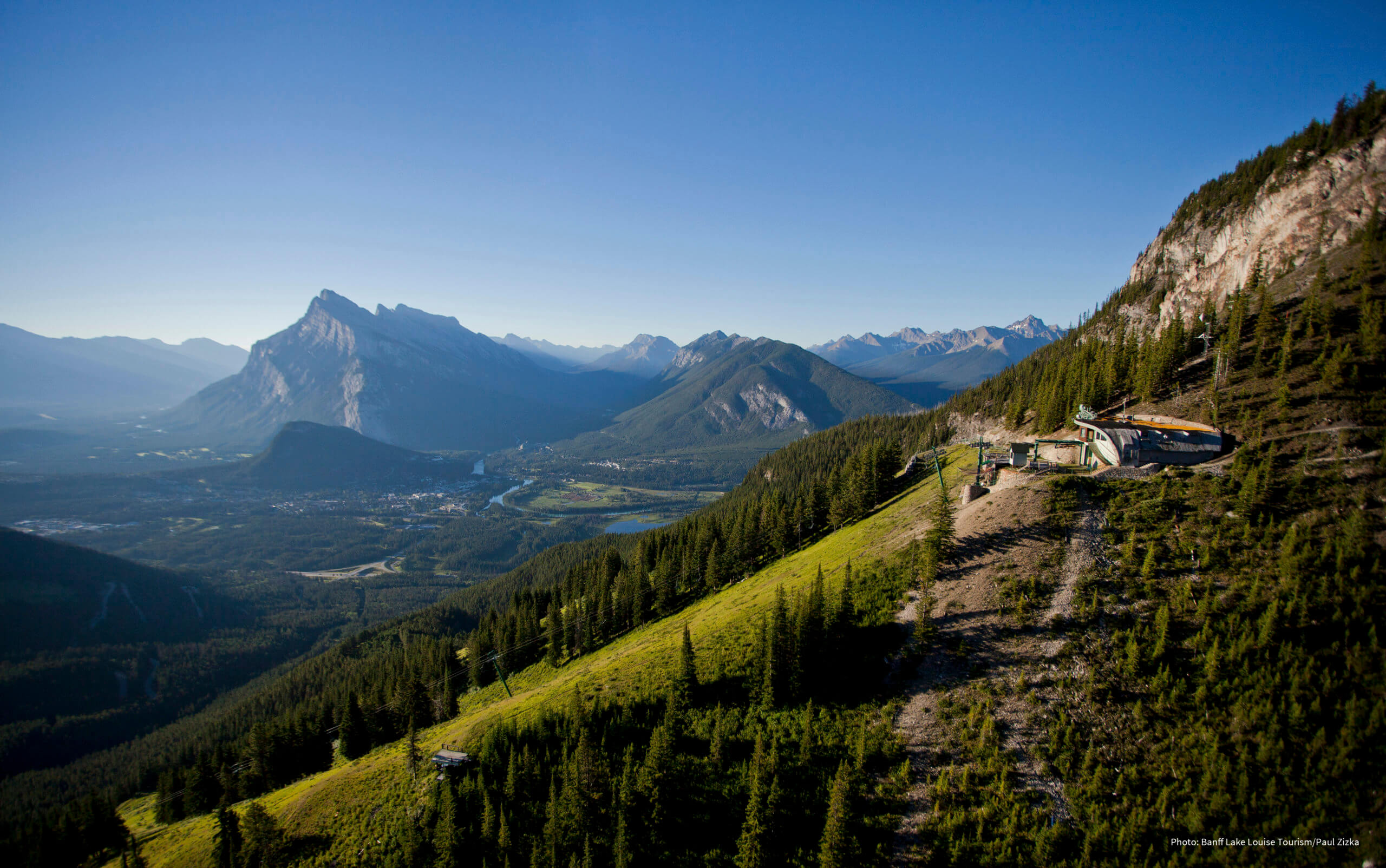
Photo by Paul Zizka
Where are the Canadian Rocky Mountain Parks?
Situated in Alberta and British Columbia, the Canadian Rocky Mountain Parks region consists of seven national and provincial parks that together make up the World Heritage Site. The parks are Banff National Park, Jasper National Park, Yoho National Park and Kootenay National Park, as well as three British Columbia provincial parks (Mount Robson, Mount Assiniboine and Hamber).
Why are the Canadian Rocky Mountain Parks significant?
Together, the seven parks of the region make up some of the most recognizable mountain scenery in the world and are an exceptional example of glacial geological processes, including icefields, remnant valley glaciers and canyons. The area also includes the Burgess Shale, one of the most significant fossil areas in the world.
Why visit the Canadian Rocky Mountain Parks?
This area needs little selling — it attracts nine million visitors annually, all called here by the epic mountain beauty. Visitors are awe-struck by the jagged peaks and turquoise lakes, the huge Columbia Icefield and the vast amount of year-round activities. Whether you come for skiing or hiking or driving the icefield, you’ll leave with stunning photos and incredible memories of one of the most breathtaking places on earth.
Gros Morne National Park
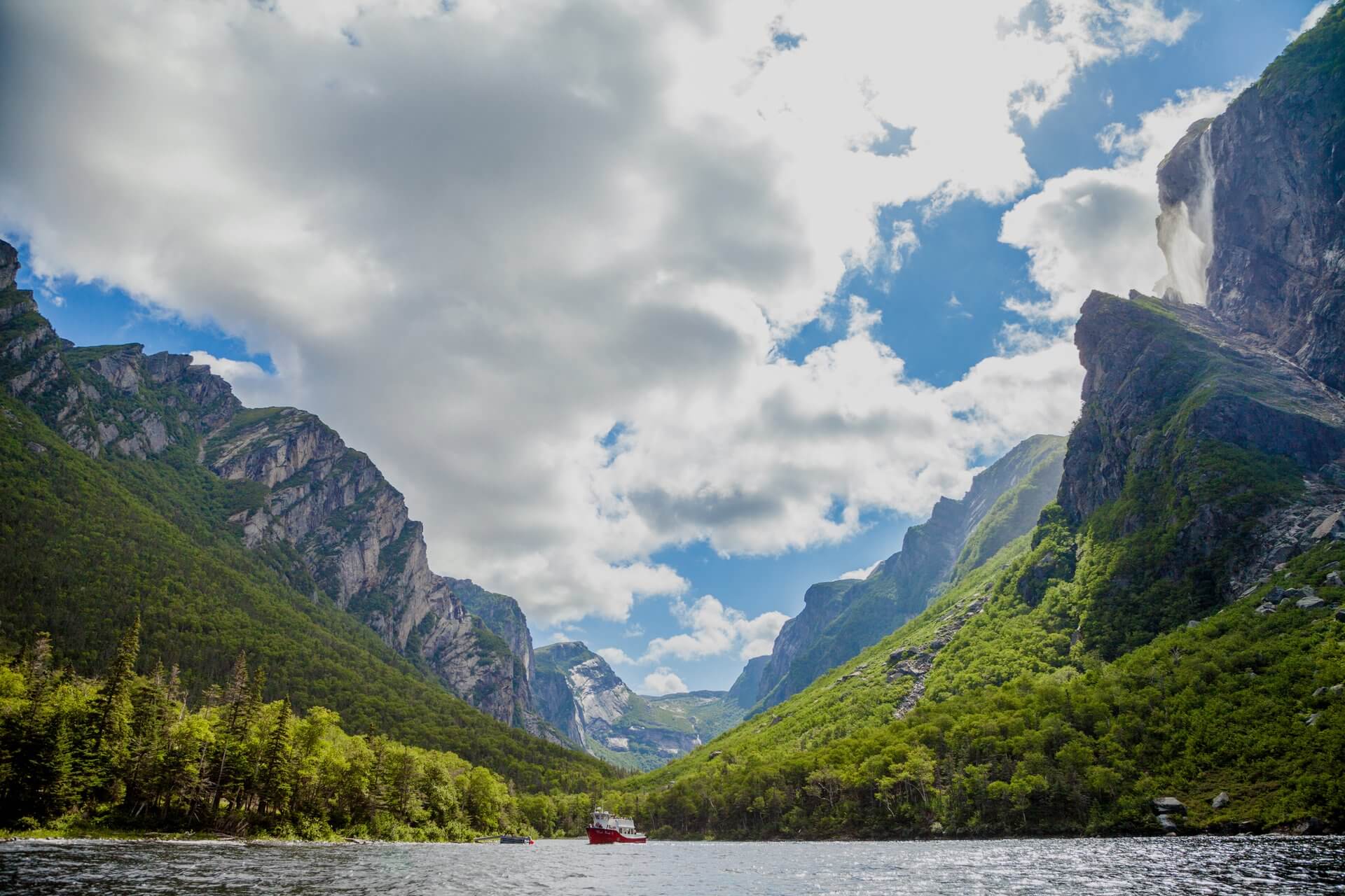
Where is Gros Morne National Park?
Gros Morne National Park sits on the west coast of Newfoundland, on the opposite side of the island from St. John’s. It would take approximately 7 hours to drive from Gros Morne to St. John’s. The closest airport to the park is in Deer Lake, which is about 30-minutes away.
Why is Gros Morne National Park a UNESCO site?
With deep fjords, dizzying waterfalls and stunning ecological features, Gros Morne amazes people with its surreal beauty. Within its relatively small footprint, the park offers a vivid example of the process of plate tectonics and their monumental impact on a landscape. According to UNESCO, Gros Morne National Park “completely portrays the progression of geological events that took place when an ancient ocean and the ancient continental margin of eastern North America were destroyed and uplifted to form a mountain chain through the action of plate tectonics.” Cool, right? This is one of those rare places where the Earth’s mantle (usually hidden) is on display.
Can I visit Gros Morne National Park?
Once you arrive in Newfoundland, Gros Morne National Park has many options for exploration. The park is divided into a north and south side by a 25 km long fjord (called Bonne Bay). The diverse landscape of the park offers so many different ways to explore: hike the Tablelands — that rare outcrop of the Earth’s mantle, cruise a freshwater fjord at Western Brook Pond or explore the Lobster Cove Head Lighthouse.
Waterton Glacier International Peace Park
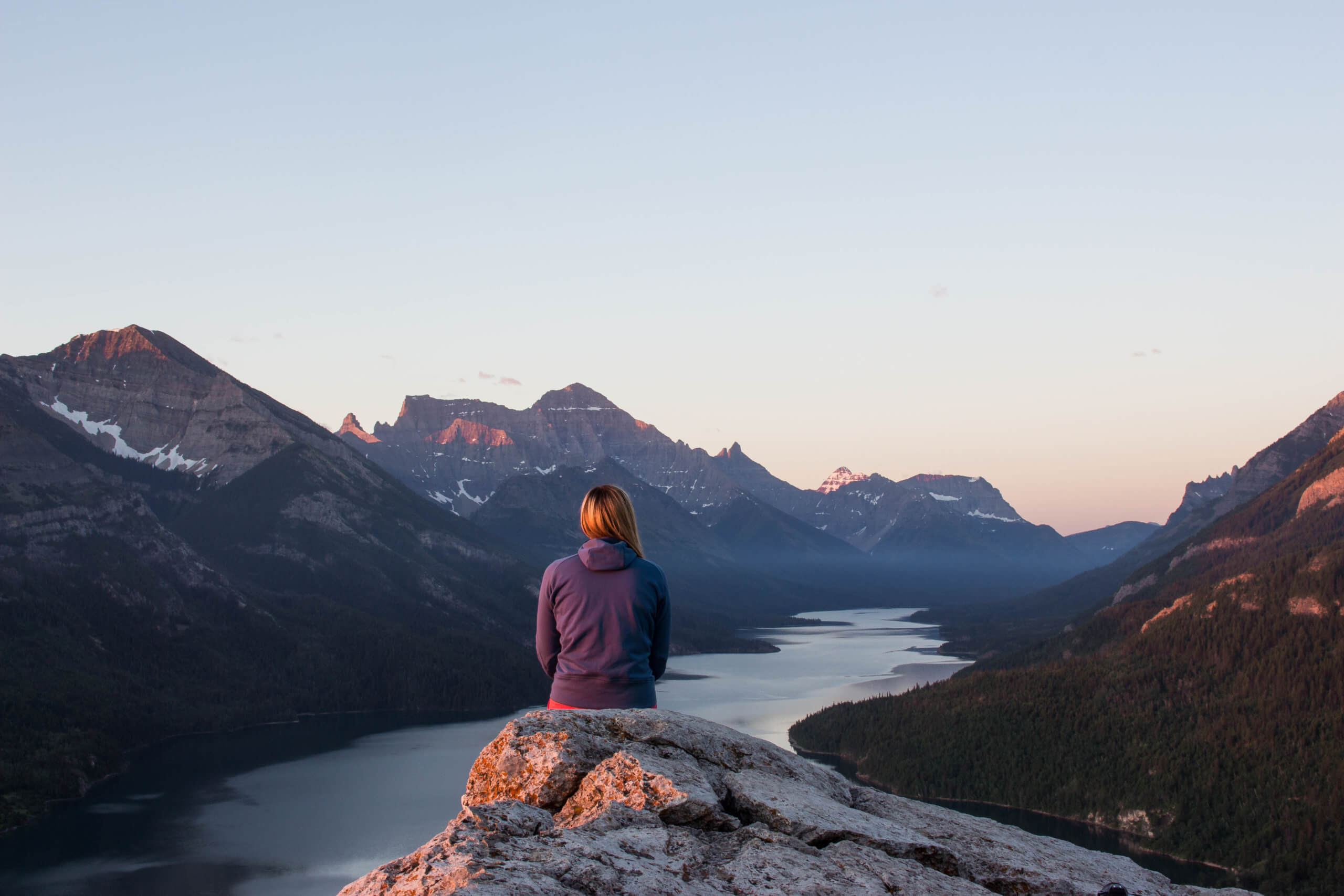
Waterton Lakes National Park. Photo by Katie Goldie
Where is Waterton Glacier International Peace Park?
The Waterton Glacier International Peace Park is a cooperative protected zone between Alberta and Montana. It unites Waterton Lakes National Park in southern Alberta (about 260 km south of Calgary) and Glacier National Park in Montana.
Why is Waterton Glacier on the UNESCO list?
The two interconnected parks form part of the Western Cordillera and have a unique position that has created plant communities and ecological zones that don’t occur anywhere else on Earth. (For those that don’t know, a cordillera is an extensive chain of often parallel mountain ranges, usually with plateaus and plains in between.)
What makes this position so unique is that it includes the headwaters of three major watersheds that each drain into a different ocean and a diverse range of ecoregions, such as prairie flatlands that suddenly give way to the Rocky Mountains. This diversity allows flora and fauna to flourish, providing a home for elk, mountain goats, bighorn sheep, grizzly bears and coyotes.
The park is the traditional territory of the Blackfoot people and Indigenous presence in this region goes back 12,000 years.
How to explore Waterton Glacier International Peace Park?
Hiking and wildlife viewing are among the top things to do at the peace park and a visit to Canada’s Waterton Lakes National Park provides plenty of opportunity to do just that. The park has 200 km of hiking trails, ranging from easy day hikes to strenuous multi-day mountain treks. For a moderate trek that offers scenic viewpoints, try the spectacular 10.4 km. Bertha Falls/Lake trail. You’ll be rewarded with a lookout over Upper Waterton Lakes, a waterfall and the beautiful blue-green Bertha Lake surrounded by mountain peaks. The park also offers camping options and the night sky here is truly spectacular.
Miguasha National Park
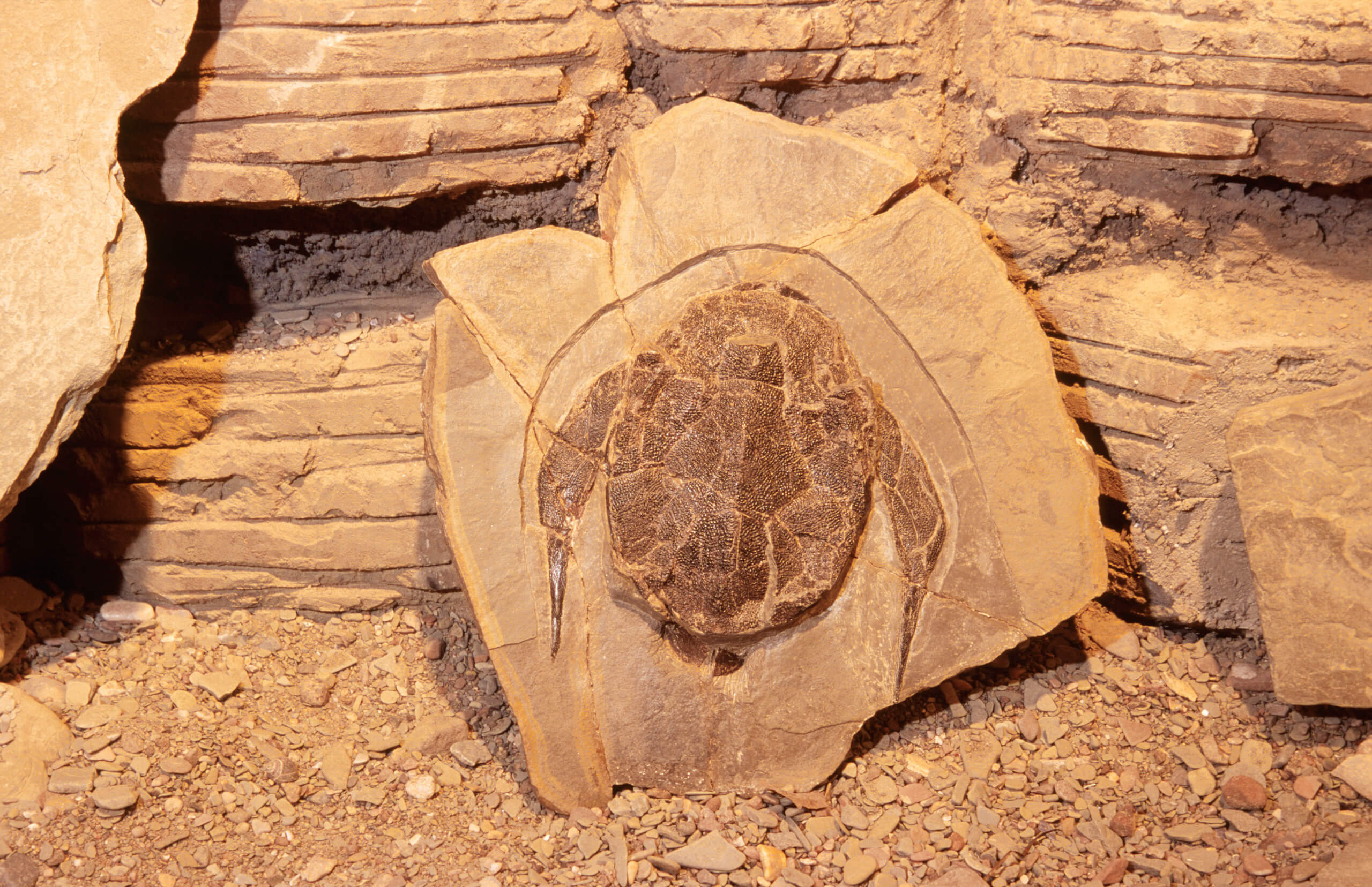
Photo by Jean-Pierre Huard
Where is Miguasha National Park?
Miguasha National Park is located on the Gaspé Peninsula region of Québec on the shores of Chaleur Bay. In Québec, provincial parks are called national parks, so despite its name, Miguasha National Park (or Parc national de Miguasha) is operated by the province of Québec.
Why is Miguasha National Park a UNESCO site?
Chaleur Bay is an arm of the Gulf of St. Lawrence located between Quebec and New Brunswick, known for its fossil-rich environment. It is along the shores of this bay that you’ll find Miguasha National Park, home to seaside cliffs that contain the finest fossil site of vertebrate life in the world. It has the greatest number of fossil specimens of the lobe-finned fishes — a snapshop of what life was like millions of years ago when fish ruled the world.
Is Miguasha National Park worth a visit?
This compact park offers visitors an unparalleled glimpse into prehistoric life. Discover plant and fish fossils dating from the Devonian Period (380 million years ago) through the park’s permanent exhibits. You can stroll along the “Evolution of Life” trail along the fossil cliff, which has beautiful scenic views or do a guided activity to better understand the fossil formations and digs at the foot of the cliff. The park is open seasonally.
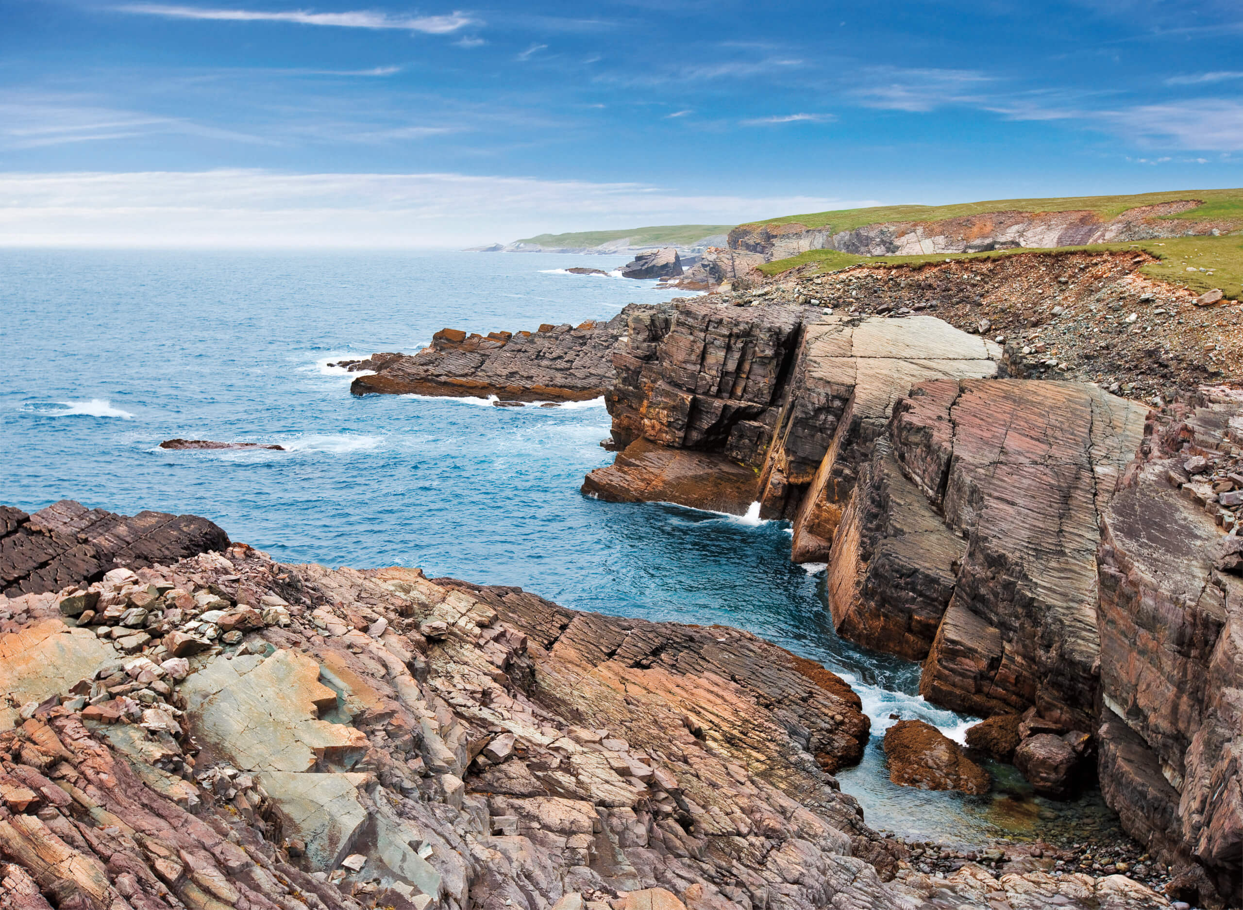
Joggins Fossil Cliffs

Views at the Joggins Fossil Cliffs at sunset
Where are the Joggins Fossil Cliffs located?
The Joggins Fossil Cliffs are located in Nova Scotia, on the northern arm of the Bay of Fundy. To reach the cliffs from Halifax, you’ll have to allocate about two and a half hours of driving time.
Why are the Joggins Fossil Cliffs significant?
Like the fossil cliffs of Miguasha National Park, Joggins also offers a glimpse into the evolution of life on Earth. The exposed rocks of these cliffs are the best fossil record in the world of the what is known as the Pennsylvanian “Coal Age” — a time 300 million years ago when the area was a tropical wetland forest. According to UNESCO, “the site bears witness to the first reptiles in Earth history, which are the earliest representatives of the amniotes, a group of animals that includes reptiles, dinosaurs, birds and mammals.”
Exposed as they are to the world’s highest tides, the cliffs at Joggins continue to offer pieces of the puzzle in our understanding of evolution of life. To date, more than 200 fossilized species of animals and plants have been found here from the Carboniferous Period.
What are the things to do at Joggins Fossil Cliffs?
Joggins Fossil Cliffs comprise nearly 15 km of coastline along the Bay of Fundy and can be explored independently or through a guided tour. What makes a trip to Joggins so exciting is that the high tides continue to expose new fossils so the sense of discovery is a big draw for many. During low tide, you can walk on the ocean floor and gaze up at the 30-metre-high cliffs in search of fossils. Guided walks are recommended as staff is knowledgeable and can put into context the amazing things you are seeing. The Joggins Fossil Centre is also worth a visit.
Mistaken Point
Mistaken Point Ecological Reserve. Photo by Barrett & MacKay
Where is Mistaken Point?
Mistaken Point is located in the Avalon Peninsula on the southeastern tip of Newfoundland, approximately 140 km from St. John’s.
Why is Mistaken Point a UNESCO site?
Canada’s east coast is a hotbed of fossil activity and Mistaken Point offers yet another piece in the evolution puzzle. The fossil discovery here has been significant because it documents the first appearance of large, complex organisms, including the first ancestral animals. Dating back 580 to 560 million years, the fossils show soft-bodied creatures that lived on the deep sea floor during the Ediacaran Period when the world was covered by an ancient ocean. Mistaken Point has the most abundant display of Ediacaran fossils in the world.
Are visitors allowed at Mistaken Point?
To see the fossils located within the Mistaken Point Ecological Reserve, visitors must take a guided tour. This is to protect the delicate nature of the area. Guided tours introduce visitors to the history of the area and allow them to see the fossils up close. Visitors have a chance to walk on the surface of the bedding planes filled with thousands of fossils. As the area can be slippery, visitors are asked to wear proper hiking footwear. Tours are small and can book up quickly so reservations are recommended.