A Journey Through Canada’s Cultural UNESCO World Heritage Sites
Lunenburg, Nova Scotia. Photo by Ryan Williams/Tourism Nova Scotia
From the ancient remains of a Viking village in Newfoundland to the remarkable cedar longhouses and memorial poles of the Haida First Nation in British Columbia, Canada is full of cultural wonders.
At Landsby, we are committed to showcasing all the incredible places you can explore in Canada from coast to coast to coast — so today we are looking at the sites all around the country that have been designated as culturally significant by UNESCO (the United Nations Educational, Scientific and Cultural Organization). These World Heritage Sites are deemed to have incredible value not just to Canadians but to humanity at large.
How many UNESCO heritage sites does Canada have?
There are a two different UNESCO designations for World Heritage Sites: cultural and natural.
Canada is currently home to 20 World Heritage Sites: 9 Cultural, 10 Natural and 1 site that falls under both designations. This post will take an indepth look at the 9 cultural sites and 1 mixed site in Canada: where the sites are located, why they are significant and how you can explore them.
If you are looking for information on the 10 World Heritage Sites that have been deemed significant for their natural ecosystems, stay tuned! We’ve got that blog post coming up as well.
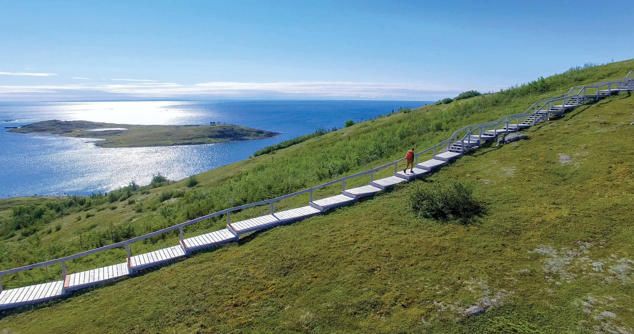
Writing-On-Stone/Áísínai’pi Provincial Park
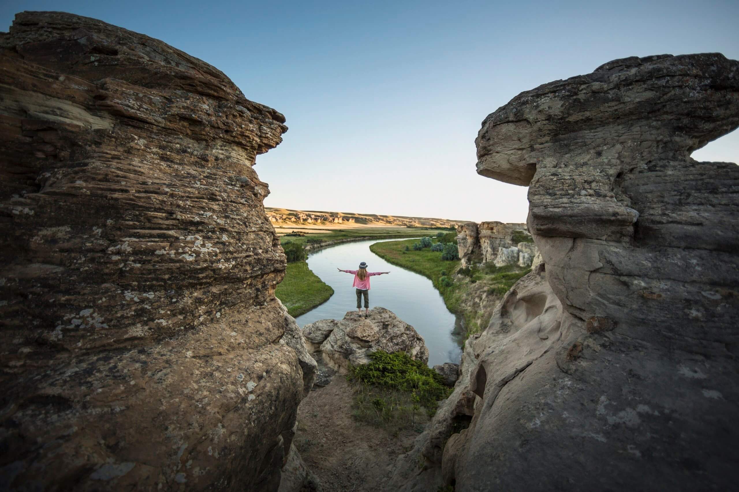
Writing-on-Stone Provincial Park. Photo by Sabrina Hill/Travel Alberta
Where is Writing-on-Stone World Heritage Site located?
Writing-on-Stone/Áísínai’pi Provincial Park is located in Southern Alberta, approximately 100 km southeast of Lethbridge in the Milk River valley. The Milk River flows through the park and is surrounded by a scenic badlands landscape of sandstone cliffs, canyons and grasslands.
Why is Writing-on-Stone culturally significant?
The stunning landscape of the region was formed millions of years ago, but it is the happenings of the last 10,000 years that have earned Writing-on-Stone its cultural designation on the UNESCO list. Filled with petroglyphs (rock carvings) and pictographs (rock paintings), Áísínai’pi is a sacred heartland for the Blackfoot people who have lived on these lands for thousands of years. The rock art left here over generations is one of the most profound examples of spiritual messages and provides a tangible link to Indigenous ancestors of the Plains First Nations. It is the largest concentration of petroglyphs and pictographs in this part of the world.
What’s there to do in Writing-on-Stone?
Visiting the provincial park is a spiritual experience for many. A guided, interpretive hike of the rock art is a must-do as it really showcases the true cultural value of the region. See the carvings, hear the stories and experience the striking beauty of the surrounding region. You’ll soon see why this place has been a sacred haven for spiritual visionaries for thousands of years. In addition to the incredible rock carvings, archaeologists have uncovered evidence from the prairies around this park that people have lived here for at least 10,000 years.
The park also has a few wonderful hiking options, including the 2.5 km (one way) Matapiiksi (Hoodoo) Trail. There is also a shaded campground set among the cottonwood trees in the Milk River valley, with unserviced as well as powered sites.
SGang Gwaay

Totems at SGang Gwaay Llanagaay. Photo by Brandon Hartwig/Destination BC
Where is SGang Gwaay?
SGang Gwaay lies within the boundaries of the Gwaii Haanas National Park Reserve on Haida Gwaii. Once known as the Queen Charlotte Islands, Haida Gwaii is a stunning and remote archipelago off the coast of British Columbia, just south of the Alaskan Panhandle. SGang Gwaay is on the southwestern side of the archipelago.
Why is SGang Gwaay culturally significant?
SGang Gwaay once housed a thriving community, occupied by the Haida people until shortly after 1880. Today, the remains of the large cedar long houses and memorial poles are all that is left — a singular example of a 19th century Haida village, the only one of its kind in the world. SGang Gwaay showcases the rich culture of the Haida and is a visual reminder of their oral traditions. The weathered poles offer a glimpse into the past, displaying family crests and representing a connection to the supernatural.
Is it easy to visit SGang Gwaay?
Accessible only by boat or seaplane, this remote region of British Columbia is a true wilderness experience that is best explored with a Haida guide. Visitors must have a permit to enter this protected area.
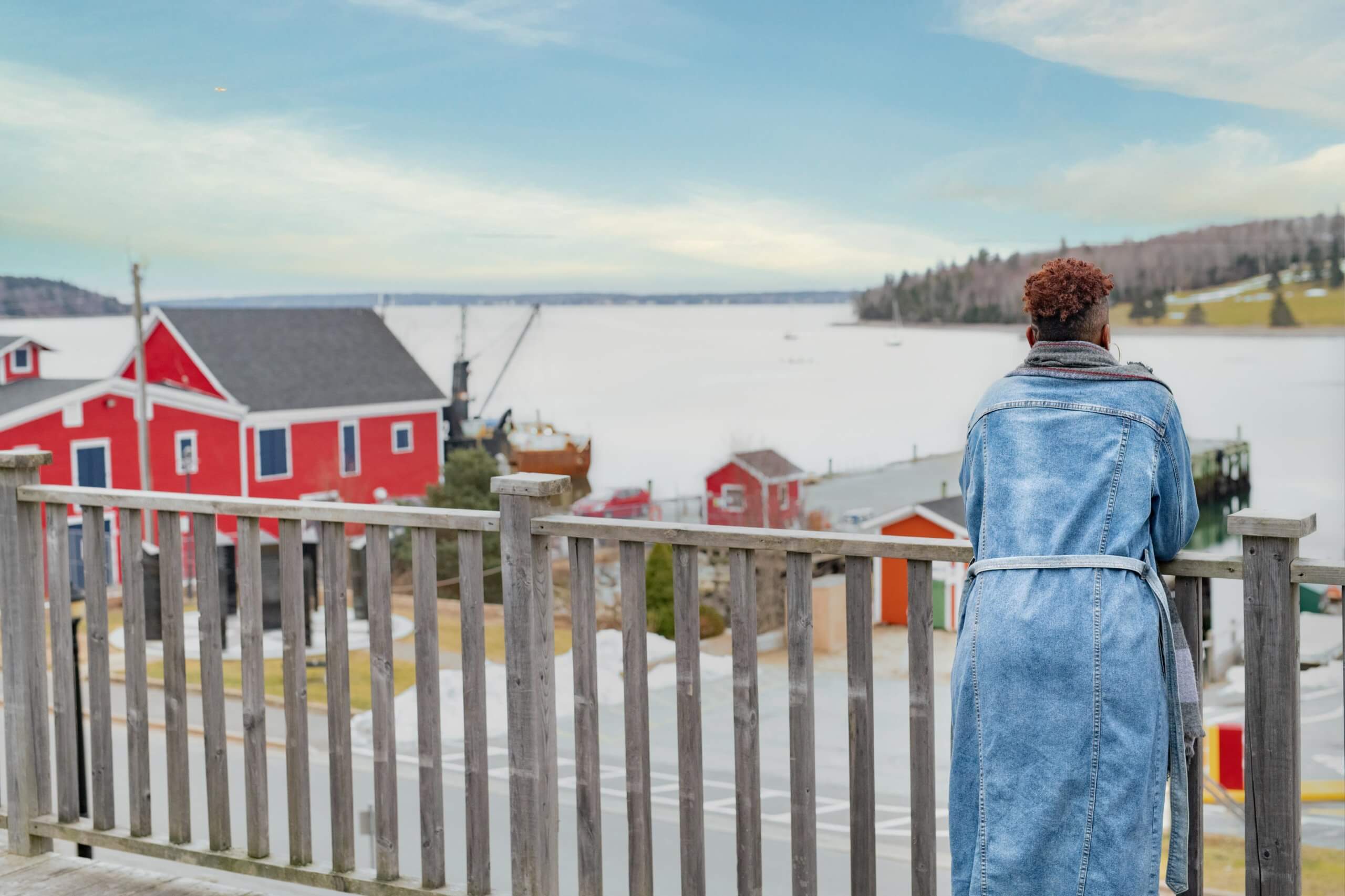
Old Town Lunenburg

Lunenburg. Photo by Acorn Art & Photography/Tourism Nova Scotia
Where is Lunenburg?
Lunenburg is a small port town on the south shore of Nova Scotia, approximately 100 km west of Halifax.
Why is Lunenburg culturally significant?
Built in 1753, Lunenburg was one of the many planned British colonial settlements with a rectangular grid pattern that had been drawn up in England. What makes Lunenburg so special is that while other settlements underwent changes, this port town has retained its original layout and overall appearance — thus making it the best surviving example of a planned British settlement in North America. The town has preserved centuries of wooden architecture and the original town plan remains intact in its entirety (missing only the fortifications that had surrounded the town in the very early years).
Is Lunenburg worth visiting?
If you’re looking for a picturesque Atlantic town to visit, you’d be hard pressed to find one more charming than Lunenburg. With colourful buildings, a lovely harbour and lots of shops and restaurants along its waterfront, Lunenburg is an amazing place to explore along Nova Scotia’s south shore. The town is pedestrian-friendly so taking long walks around the town is one of the best things to do when visiting. Explore the many artist’s studios and art shops, eat delicious seafood, take a boat cruise of the harbour and step aboard the Bluenose II — an exact replica of the famous Bluenose schooner that adorns our Canadian dime.
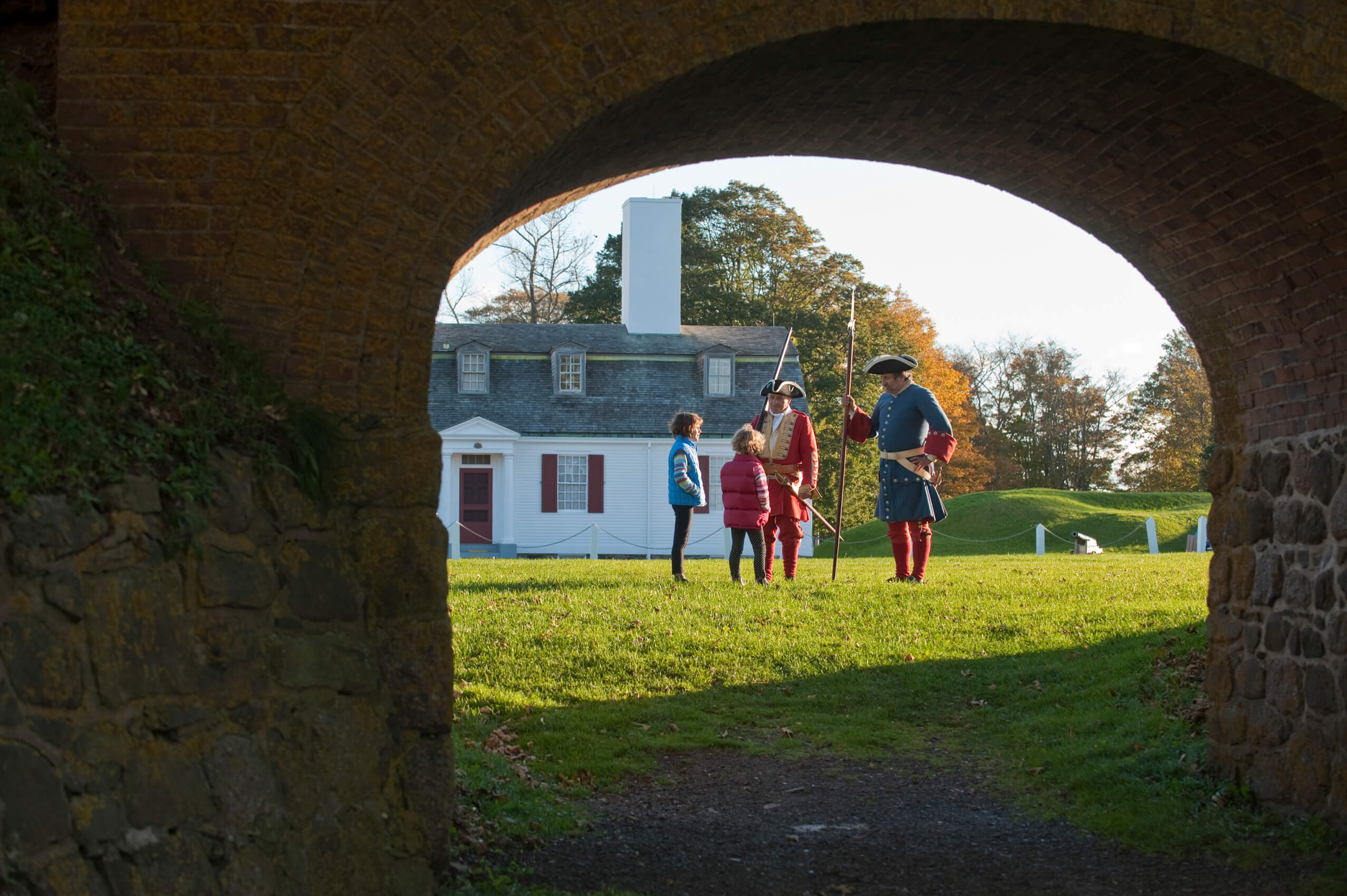
Rideau Canal

Rideau Canal National Historic Site.
Where is the Rideau Canal?
Located in eastern Ontario, the Rideau Canal stretches from Kingston to Ottawa, connecting the two cities with one continuous waterway system. It encompasses the Rideau and Cataraqui rivers.
Why is the Rideau Canal culturally significant?
When it was built in the early 19th century, the Rideau Canal was intended as a strategic military structure — a way for Great Britain to maintain political control in a region that was coveted by the United States. Today the Rideau is the best preserved example of a slackwater canal in North America and is used mostly for recreational purposes. It continues to be operational and most of the original structures are still intact.
How to explore the Rideau Canal?
Whether you explore in the winter or summer, the Rideau Canal system is a wonder to experience. In the winter, the portion of the canal that winds its way through the heart of Ottawa is turned into the Rideau Canal Skateway. This 7.8 km skating trail is the largest in the world and draws tourists all season long. In the summer, the canal is best experienced by boat but there are also many walkable trails along its banks. Read our post about the 5 Ways to Experience Ontario’s Rideau Canal this Summer for more inspiration.
Landscapes of Grand-Pré
Grand-Pre© National Historic Site of Canada / Photo by: C. Reardon
Where is Grand-Pré?
The Grand-Pré National Historic Site is located in Nova Scotia’s Annapolis Valley along the southern shores of the Minas Basin, approximately 85 km from Halifax.
Why is Grand-Pré culturally significant?
The pastoral landscapes and archaeological sites of Grand-Pré represent the heartland of Acadian culture. The name Grand-Pré — meaning great meadow — is a testament to the centuries of agricultural farming by the Acadians using unique polder methods to create thriving settlements in a challenging environment. The landscapes are one of the best example in the world of the development of agricultural farmland using dykes and the aboiteau wooden sluice system, started by the Acadians in the 17th century.
The historic site also serves as a memorial to the Acadian way of life and the mass deportation the people faced in the mid 1700s, known as the Grand Dérangement.
What’s there to do in Grand-Pré?
The best way to get to know why Grand-Pré is a site of universal cultural significance is to take a guided tour. This will give you an overview of the history of the Acadian deportation and includes a visit to the Memorial Church and a stop at the Statue of Evangeline. Tours are offered in French and English.
Cyclists can explore the area along the Harvest Moon Trailway, which is a 110 km scenic trail from Grand-Pré to Annapolis Royal. The trails go through the towns of Wolfville, Kentville and Berwick. Canada Parks has recently installed eight oTENTik (ready-to-camp structures) in the fields south of the Visitor’s Centre at the Grand-Pré National Historic Site to offer visitors an immersive experience in the beautiful landscape.
Head-Smashed-In Buffalo Jump
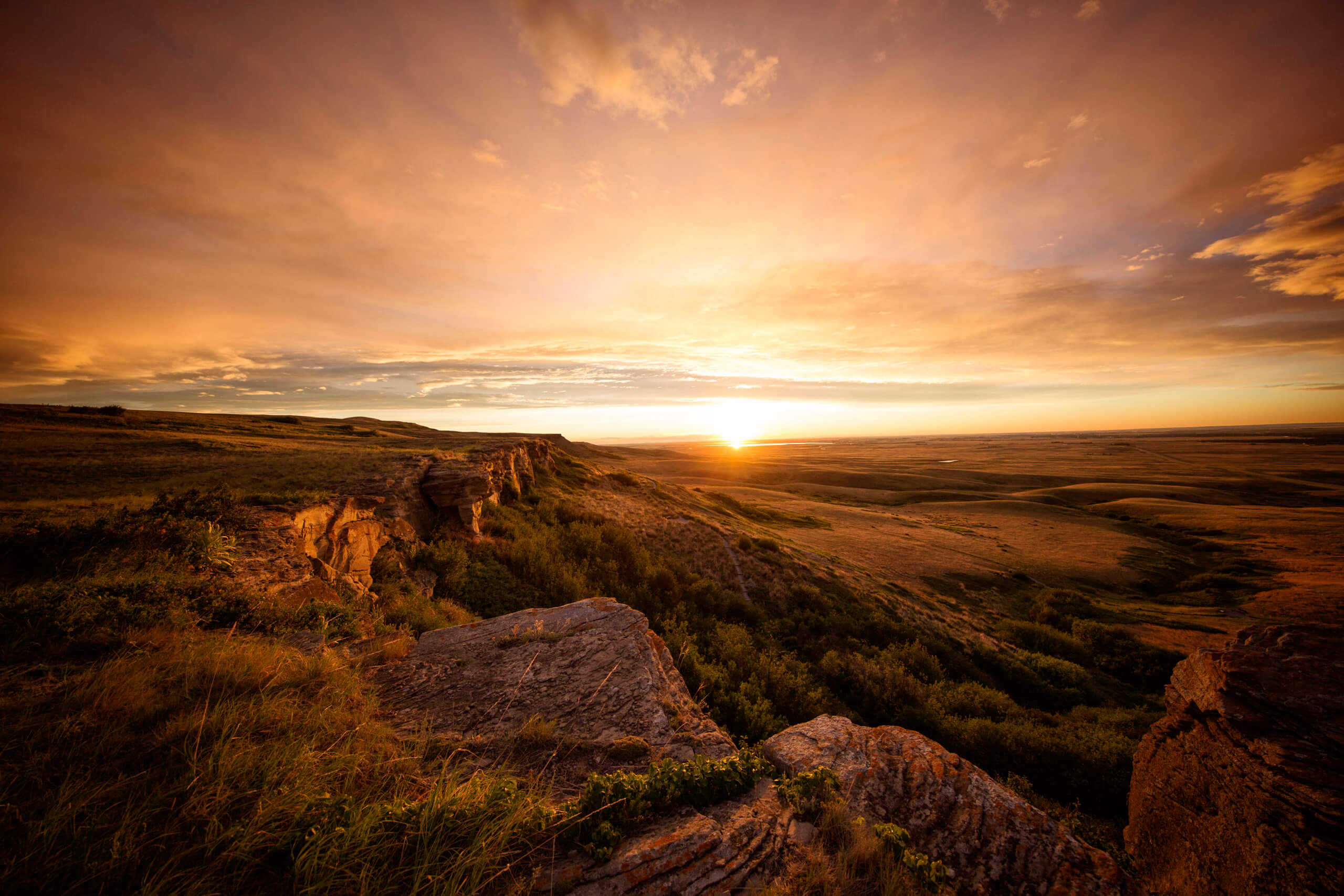
Head Smashed In Buffalo Jump. Photo by Roth & Ramberg
Where is Head-Smashed-In Buffalo Jump?
Head-Smashed-In is located in the Porcupine Hills of southwestern Alberta, approximately 45 min west of Lethbridge.
What exactly is Head-Smashed-In Buffalo Jump and why is it culturally significant?
If you’ve never heard of a buffalo jump before, this name and site might seem confusing. A buffalo jump is an ancient group hunting method employed by the Plains Indigenous people (Blackfoot) for more than 6,000 years. Hunters would use their knowledge of wild buffalo behaviour to drive the animals towards the edge of the cliff and the buffalo would fall over the edge. You can see how this spot got its name. This mass hunting practice was essential to the Blackfoot way of life as the animals provided food and materials for clothing, tools and dwellings.
While buffalo jumps were used in many places, Head-Smashed-In is one of the oldest and best preserved examples of this communal hunting technique.
What is there to do in Head-Smashed-In Buffalo Jump?
A visit to Head-Smashed-In Buffalo Jump is an immersion into Blackfoot culture and history. There is an interpretive centre and museum on site, as well as guided tours. Through storytelling and hands-on workshops lead by a Blackfoot guide, you’ll leave with an appreciation of the skill it took to be a buffalo runner as well as the way of life for people in this part of Canada for millennia.
Red Bay Basque Whaling Station
Where is the Red Bay Basque Whaling Station?
The Red Bay Basque Whaling Station is located in Labrador, where the Gulf of St. Lawrence meets the Labrador Sea. It is possible to drive to Red Bay Labrador from mainland Canada along the Québec-Labrador Highway known as Expedition 51° or alternatively, visitors to Labrador can arrive by ferry from St. Barbe, Newfoundland. The ferry will drop you off in Blanc Salon, Québec and from there it is a 1 hour drive to Red Bay.
Why is the Red Bay Basque Whaling Station culturally significant?
The tradition of Basque whaling dates back to the 1540s when thousands of men would sail across the Atlantic from southern France and northern Spain to hunt whales in the waters of eastern Canada. At the time, the waters were full of North Atlantic Right Whales (a species that is now on the endangered list) and Bowhead Whales. Whalers would kill the whales and render their blubber into oil. Whale oil was highly prized in Europe at the time and so the activity of whale hunting became one of the earliest examples of industrial-scale exploitation of North America’s natural resources.
Today, the Red Bay Basque Whaling Station stands as an outstanding example of the tradition of whale hunting by the Basques in the 16th century. It is the most extensive and best preserved whaling station of this type in the world.
What can I do in Red Bay?
Visitors will be greeted with beautiful scenery and stunning water views. The interpretive centre showcase the struggles and dangers of life as a traditional Basque whaler. Take a tour, stand at the burial ground where 140 people are buried from the sinking of the San Juan in 1565 and take a boat out to Saddle Island to find the remains of a long-ago way of life — ovens that were used to render whale fat into oil, ancient whale bones and cooperages where oil barrels were assembled.
Historic District of Old Québec
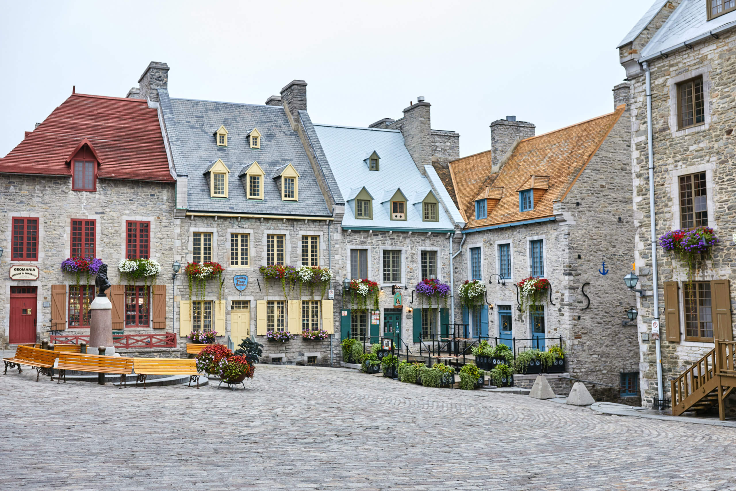
Old Quebec. Photo by Martin Laporte/Tourism Quebec
Where is the Historic District of Old Québec?
Old Québec is a historic neighbourhood in Québec City, located approximately 3 hours east of Montreal. The district consists of an upper and lower section: Upper town sits atop Cap Diamant and Lower town sits by the Place Royale and the harbour.
Why is Old Québec culturally significant?
Anyone who has ever stepped foot on the cobblestone streets of Old Québec will know that it feels more like Europe than North America. This delightful district is the spot where the capitol of New France was founded in the 17th century. Today, Québec City has grown into a bustling region but the quaint district in the oldest part of the city hasn’t changed much. One of the defining features of Old Québec is the fortifications — once built to protect the city from attack but now serve to give it the distinction of being the only walled city north of Mexico.
Nearly half of the buildings in the district were built prior to the mid 1800s, its skyline dominated by the castle-like hotel Chateau Frontenac (which has the distinction of being the most photographed hotel in the world).
What to do on a visit to Old Québec?
As in most urban centres in Canada, the list of things to do is nearly endless. Québec City, with its French charm and picturesque location on the St. Lawrence River is no different. The beautiful city is an amazing destination year round. In the winter it takes on a storybook look with snow-covered rooftops and twinkling lights. In the summer, visitors flock to enjoy the outdoor cafes, stroll along the 400-year-old streets and see the unique ramparts and gates of the fortified city. If you visit in the summer, take the ferry across the river to Lévis for stunning views of Old Québec from the water.
L’Anse aux Meadows

L’Anse aux Meadows. Photo by Barrett & MacKay
Where is L’Anse aux Meadows?
L’Anse aux Meadows is located on the northernmost tip of Newfoundland, approximately 300 km north of Gros Morne National Park.
Why is L’Anse aux Meadows culturally significant?
L’Anse aux Meadows marks the first and only known site established by the Vikings in North America. The remains of three timber-and-sod longhouses and five smaller buildings are 1000 years old and mark the first evidence of European settlement on the continent. This is significant because the settlement that followed it changed the course of the world’s history, forever interrupting the way of life of Indigenous people and establishing new migration routes.
Excavations of this site have revealed the 11th- century wood-framed and peat-turf buildings that mimic the Norse style of those found in Greenland and Iceland, as well as hundreds of Viking artefacts, some made from wood and other from iron, stone, bronze and bone.
How can I explore L’Anse aux Meadows?
Visiting L’Anse aux Meadows is like travelling back in time to stand in the footsteps of the Vikings. Visitors can try their hand at blacksmithing and weaving while guides in costume bring the whole experience to life. A few kilometres away is Norstead, a recreated Viking port where Norse games and activities abound. The Snorri, a replica Viking ship, is also worth a visit.
Pimachiowin Aki
Woodland Caribou Provincial Park. Photo by Rob Stimpson/Ontario Parks
Where is Pimachiowin Aki?
Pimachiowin Aki is a large tract of wilderness that straddles the border between Manitoba and Northern Ontario, encompassing Woodland Caribou Provincial Park on the Ontario side and Atikaki Provincial Wilderness Park, Poplar River First Nation, Pauingassi First Nation, Little Grand Rapids First Nation and Bloodvein River First Nation on the Manitoba side.
Why is Pimachiowin Aki significant?
Pimachiowin Aki is the first site in Canada to be recognized with a mixed cultural and natural UNESCO designation. In Anishinaabemowin, the name means “the land that gives life” and this land has, for thousands of years, been home to the Anishinaabeg as well as an abundance of flora and fauna. From a natural perspective, it is significant as one of the largest intact boreal forest ecosystems left in North America. A landscape of rivers, lakes and wetlands among pristine forests that are home to one of the largest groups of woodland caribou south of Hudson Bay.
Culturally it is significant because it is a testament to the ancient Ojibwe conservation practices of Ji-ganawendamang Gidakiiminaan (keeping the land). This tradition of being bound to the land by the Creator continues today and involves ceremonies at specific sites to communicate with spiritual beings, as well as paying respect at sacred places in order to ensure harmonious relationships between people and the other beings that inhabit the space.
How can I explore Pimachiowin Aki?
The wilderness of Pimachiowin Aki makes it a perfect destination for eco-tourism and adventure travel. Tours with one of the First Nation communities would be amazing or you can visit one of the two provincial parks that sit within the borders. Woodland Caribou Provincial Park in Ontario has almost 2,000 km of maintained canoe routes and offers backcountry camping. Although it is a paradise for paddlers and nature-lovers, this remote park in Northern Ontario sees fewer than 1,000 paddlers per season. In Manitoba, Atikaki Provincial Wilderness Park is a spectacular rugged landscape that is only accessible by air or canoe.
Pingback: National Treasures: A Look At Canada's Natural UNESCO Heritage Sites - Landsby