
12 Things You Probably Didn’t Know About the Northwest Territories


Most people know the Northwest Territories for the Northern Lights. But that’s only one aspect of a place where some of Earth’s oldest rocks sit alongside some of Canada’s youngest roads, lakes are deep enough to swallow skyscrapers, and highways appear each winter only to disappear again in spring.
Here are 12 things you might not know about the Northwest Territories.
1. Some of the oldest rock on Earth is here
About 300 kilometres north of Yellowknife, near the Tłı̨chǫ community of Wekweètì, an outcrop of rock dates back more than four billion years.
Known as the Acasta Gneiss, it is the oldest exposed rock ever found on Earth. For geologists, rocks this old offer a rare window into the planet’s earliest history and clues about how its first continental crust formed.
Considering Earth itself is about 4.5 billion years old, the rocks beneath this part of the NWT have been here for almost as long as the planet itself.
2. Two of Canada’s most remarkable lakes are here
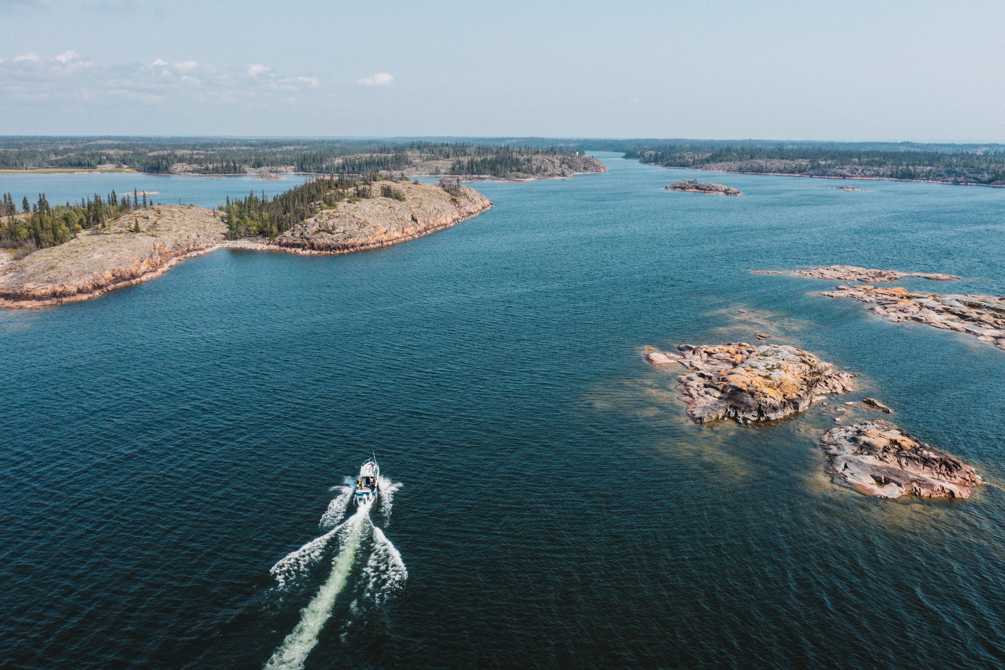
At roughly 31,000 square kilometres, Great Bear Lake is the largest freshwater lake located entirely within Canada. Its cold, clear waters are known for enormous lake trout, and Délı̨nę, on its western shore, is the lake’s only permanent community.
To the south, Great Slave Lake is the deepest lake in North America, reaching more than 614 metres (more than 2,000 feet) at its deepest point. That’s deep enough to submerge Toronto’s 553-metre CN Tower.
Both lakes have long shaped where people live, fish and travel in the NWT.
3. Some Arctic hills are still growing
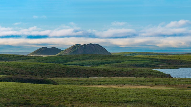
The rounded hills rising above the tundra near Tuktoyaktuk aren’t ordinary hills. Pingos have cores of ice, formed as groundwater freezes and expands beneath the surface, pushing the ground upward.
The Mackenzie Delta has the highest concentration of pingos on Earth, with approximately 1,350. Among them is Ibyuk Pingo, which stands about 49 metres high and is estimated to be around 1,300 years old.
It’s also still growing, rising by roughly two centimetres each year. Pingos have long served as landmarks and lookout points for Inuvialuit travelling across the region.
4. You can drive all the way to the Arctic Ocean
Until 2017, Canada’s all-season road system stopped short of the Arctic Ocean.
That changed with the opening of the 138-kilometre Inuvik–Tuktoyaktuk Highway, connecting Inuvik with Tuktoyaktuk on the Beaufort Sea.
The journey begins much farther south on the Dempster Highway, which crosses the Arctic Circle before reaching Inuvik. From there, the newer highway continues across the tundra to Tuktoyaktuk and the Arctic coast.
5. Some roads and highways only exist in winter
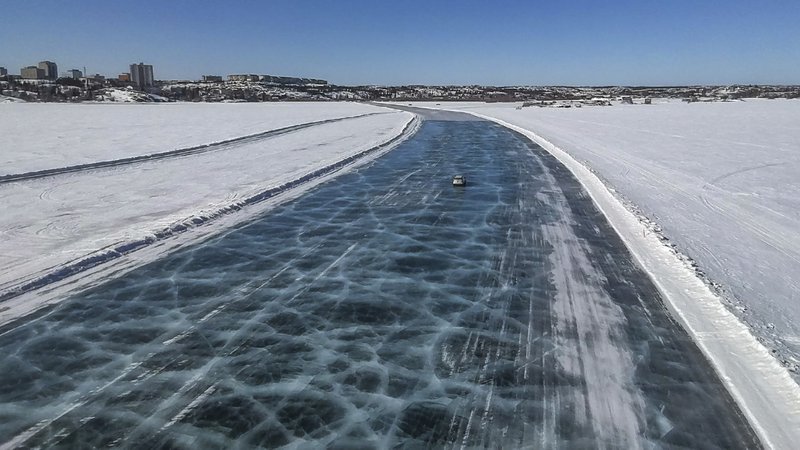
Nearly 1,500 kilometres of winter roads are built across frozen lakes, rivers and terrain each year, temporarily connecting communities without year-round road access. Some sections become ice roads, travelling directly over frozen lakes and rivers once the ice is thick enough to safely support vehicles.
For a few months, these seasonal routes become vital transportation corridors, allowing residents to drive between communities and making it possible to move fuel, building materials, groceries and other heavy supplies that can be difficult or expensive to transport by air. When temperatures rise and the ice begins to deteriorate, the roads close and the landscape becomes impassable by vehicle once again.
6. There’s a reason the Aurora is so reliable here
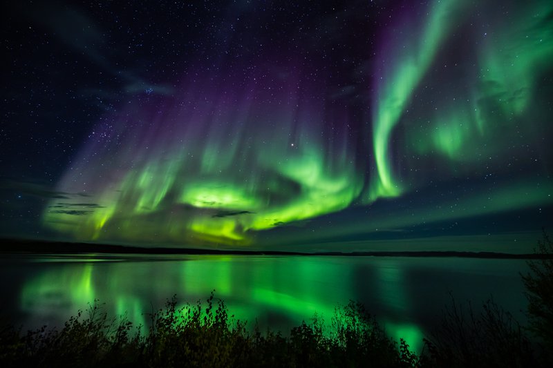
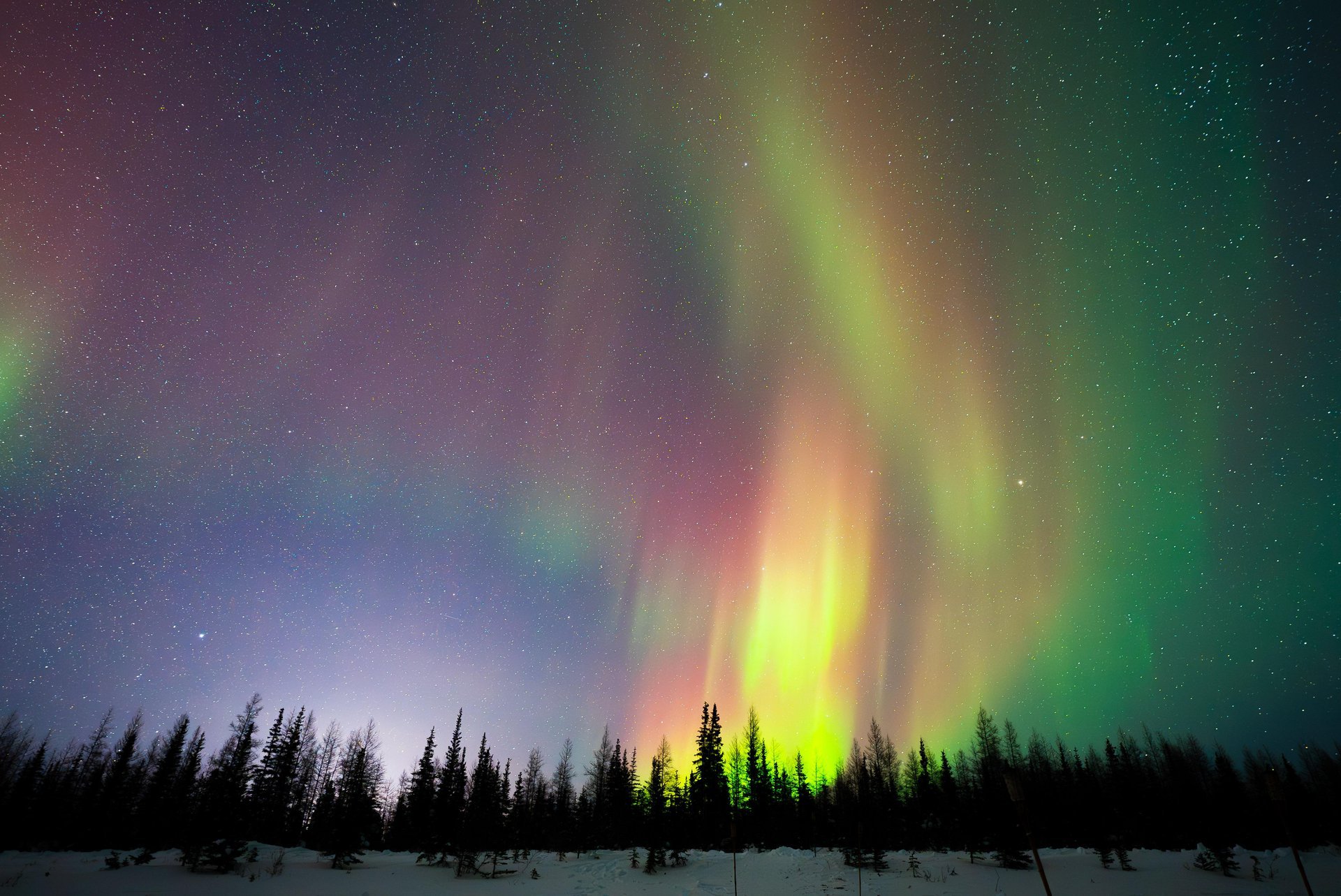
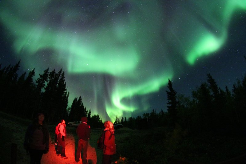
The Northwest Territories sits beneath the Auroral Oval, the band around Earth’s magnetic poles where Aurora activity is most concentrated. Add low humidity and frequently clear skies and conditions are particularly favourable for seeing the Northern Lights.
In the central Northwest Territories, the Aurora can be visible up to 240 nights each year, with two viewing seasons: mid-August to Mid-October and early December to mid-April
It’s one reason Yellowknife has become one of the world’s best-known destinations for Aurora viewing.
7. The Aurora has stories as well as science
Science explains the Northern Lights as charged particles from the sun interacting with gases in Earth’s atmosphere. But people across the Northwest Territories have been watching them for thousands of years.
Different Dene and Inuvialuit traditions carry different stories and teachings about the Aurora. Some connect the lights with ancestors or those who have died; others include warnings about whistling at them.
There isn’t one Indigenous interpretation of the Aurora. Hearing these stories from the people who carry them offers another way to understand the sky beyond the science — and the photograph.
8. Summer can feel almost endless
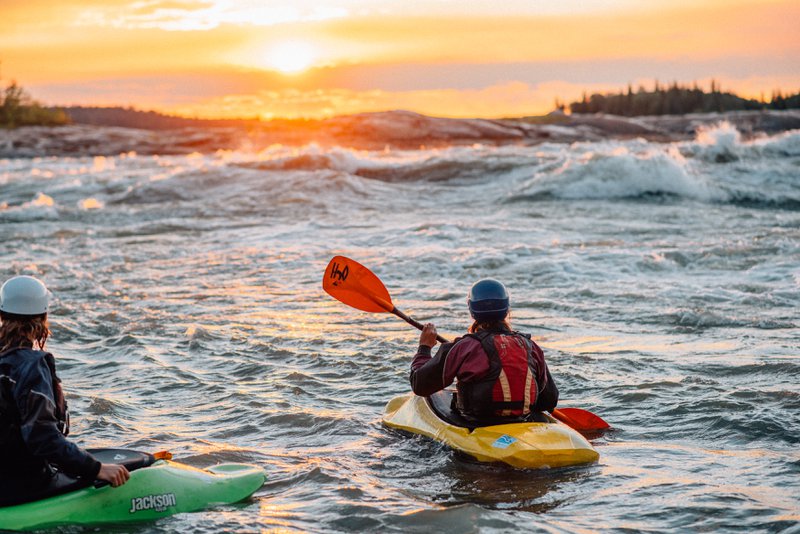
Around the summer solstice, the sun sets shortly before midnight in Yellowknife and the sky never becomes fully dark. Travel farther north and sunset disappears altogether for weeks at a time.
Those extra hours change what a summer day looks like. People golf at midnight, fish and paddle late into the evening and gather for festivals beneath the Midnight Sun.
9. Canada’s largest national park protects much more than bison
At nearly 45,000 square kilometres, Wood Buffalo National Park is Canada’s largest national park, protecting an extraordinary mix of landscapes and wildlife. It straddles the border between northern Alberta and the Northwest Territories.
Wood bison roam its forests and plains, endangered whooping cranes nest here, and natural salt water rising from an ancient seabed creates the park’s Salt Plains. It’s also home to the world’s largest known beaver dam and has been designated the world’s largest Dark Sky Preserve.
Among its best-known residents are wood bison, North America’s largest land mammals, which can weigh more than a tonne.
10. Even the licence plates tell a story
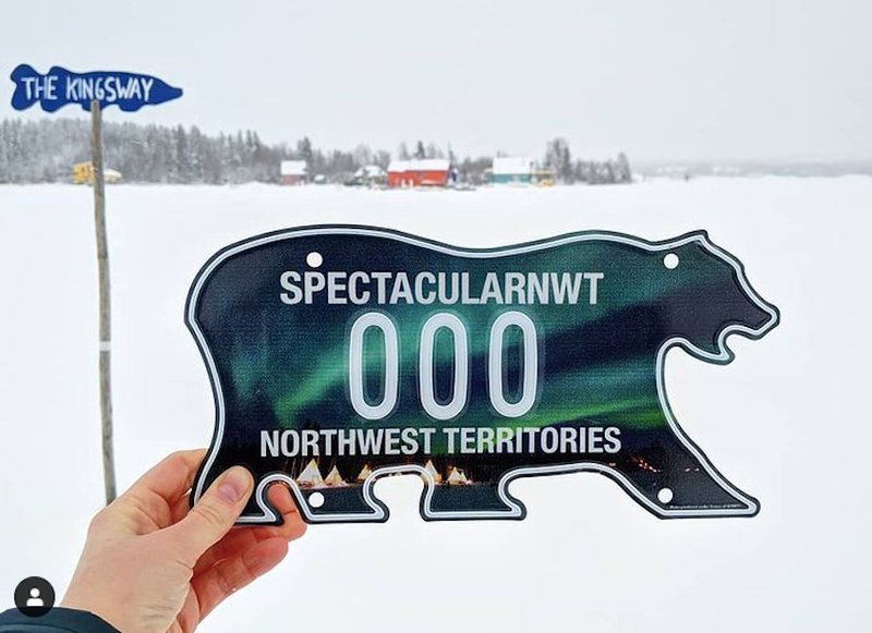
The NWT’s famous polar bear-shaped licence plate was introduced in 1970 to mark the territory’s centennial.
Then-Commissioner Stuart Hodgson designed it to comply with standardized North American licence-plate dimensions while taking advantage of one loophole: the rules didn’t say the plate had to be rectangular.
The design stuck. More than half a century later, the distinctive polar bear remains on Northwest Territories vehicles and is sought after by licence-plate collectors.
11. The Northwest Territories has 11 official languages
English and French are only two of them.
The NWT officially recognizes 11 languages. The nine Indigenous languages recognized are: Dëne Sųłıné Yatıé (Chipewyan), Gwich’in, Sahtúǫt’ı̨ne Yatı̨́ (North Slavey), Dene Zhatıé (South Slavey), Tłı̨chǫ, Inuktitut , Inuvialuktun, Inuinnaqtun, and Nēhiyawēwin (Cree).
That linguistic diversity is a reminder that the Northwest Territories isn’t one cultural region. It encompasses the homelands of distinct First Nations, Inuit and Métis peoples, with their own histories, languages, traditions, and relationships to place.
12. It isn’t empty. It’s enormous.
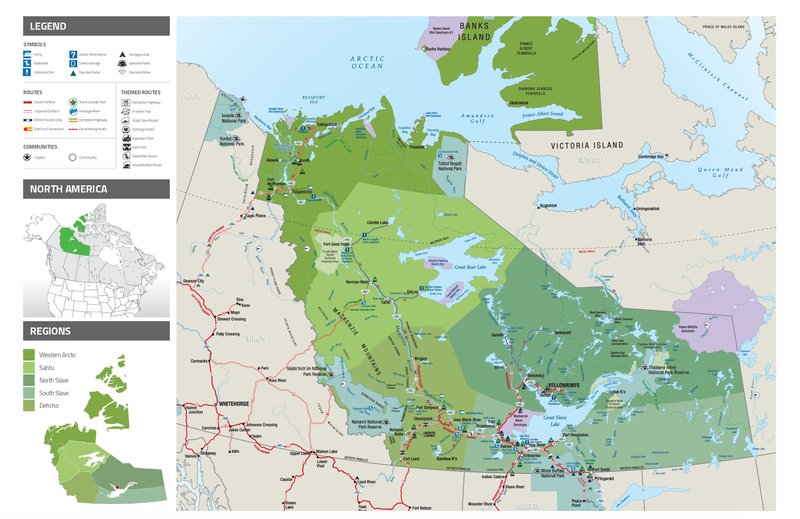
The Northwest Territories covers roughly 1.3 million square kilometres, stretching from boreal forest to Arctic coastline. Across that vast area are 33 communities, some connected by permanent highways and others reached by air or seasonal roads.
Running through much of the territory is the Dehcho (Mackenzie River), which flows 1,738 kilometres from Great Slave Lake to the Arctic Ocean. Its watershed drains roughly one-fifth of Canada, and the river has served as an important travel and transportation route for generations.
Beyond the lines and labels of a map lies a living landscape of Indigenous homelands, communities, cultures, harvesting areas and travel routes, shaped by thousands of years of history, stewardship and connection.
The Northwest Territories is vast, but it isn’t one landscape, one culture or one experience. The closer you look, the more diverse — and interesting — the map becomes.