Guide To Hiking Ontario’s Bruce Trail
 While Ontario’s Bruce Trail may not have the jaw-dropping mountain landscapes of the Rockies or the stunning ocean views of Canada’s coastal hikes, the trail has a quiet beauty all its own. It meanders for more than 900 km over ancient rock and through some of the longest remaining tracts of forest in southern Ontario. It has the distinction of being Canada’s oldest and longest marked footpath, taking hikers from Niagara to Tobermory, and is maintained almost entirely by volunteers.
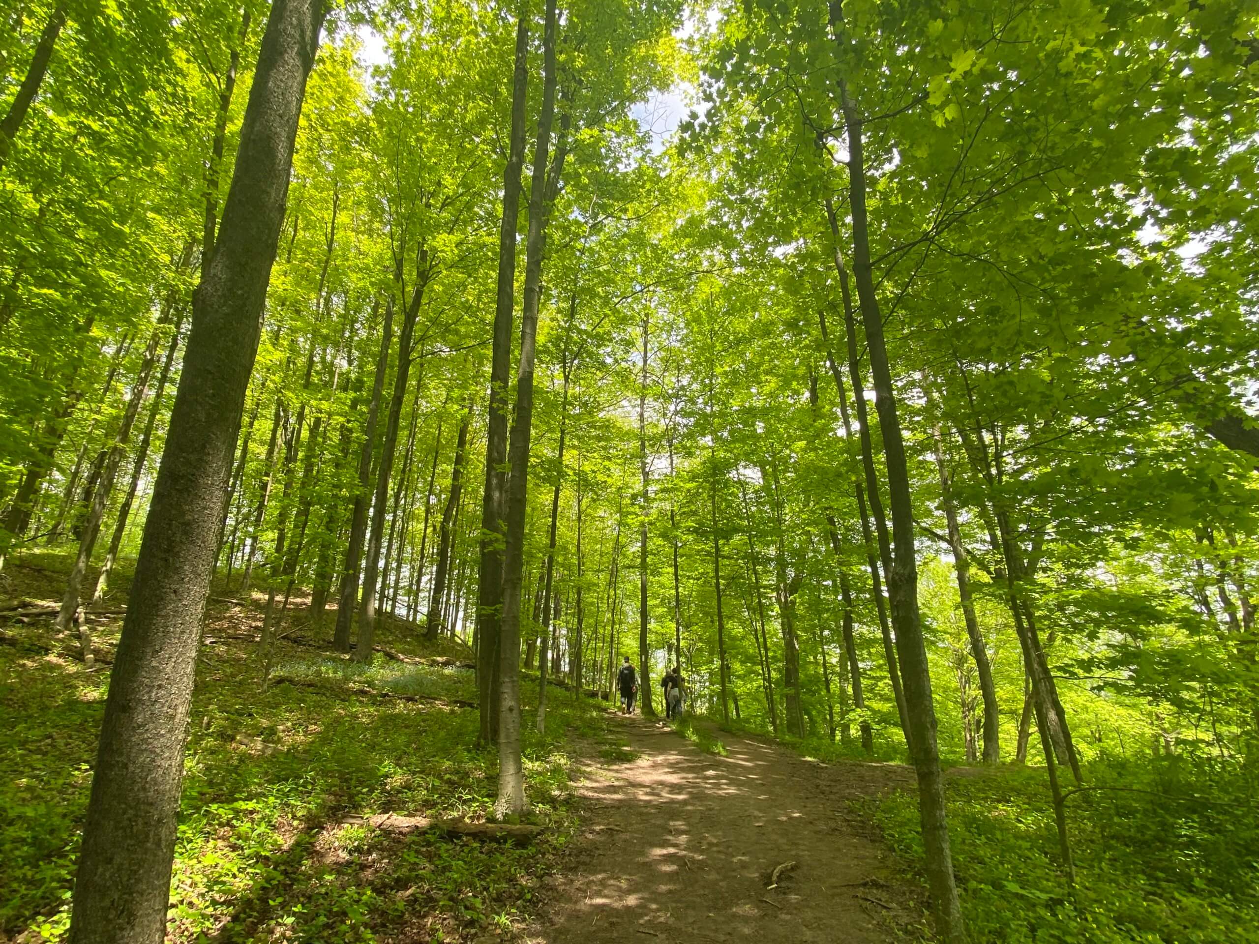
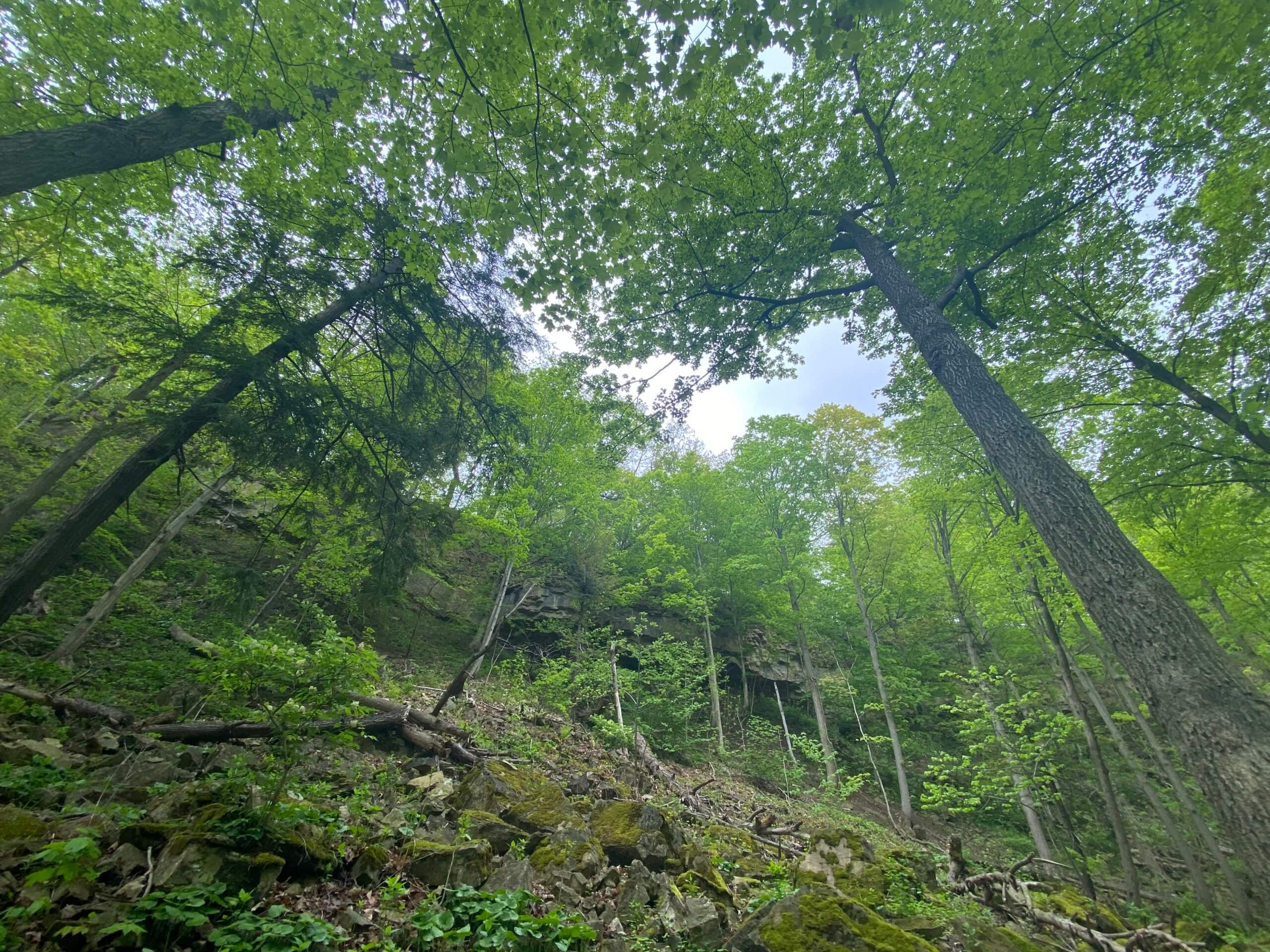
On a recent spring day, the Landsby team went out on the Bruce Trail for a guided half-day hike through part of the Iroquoia section. We walked under a canopy of green — moody in the shadows and glowing a brilliant chartreuse when the sun filtered through. We left with an appreciation of why this trail beckons hikers again and again.
Read on below for a guide to hiking the Bruce.
What is the Niagara Escarpment?
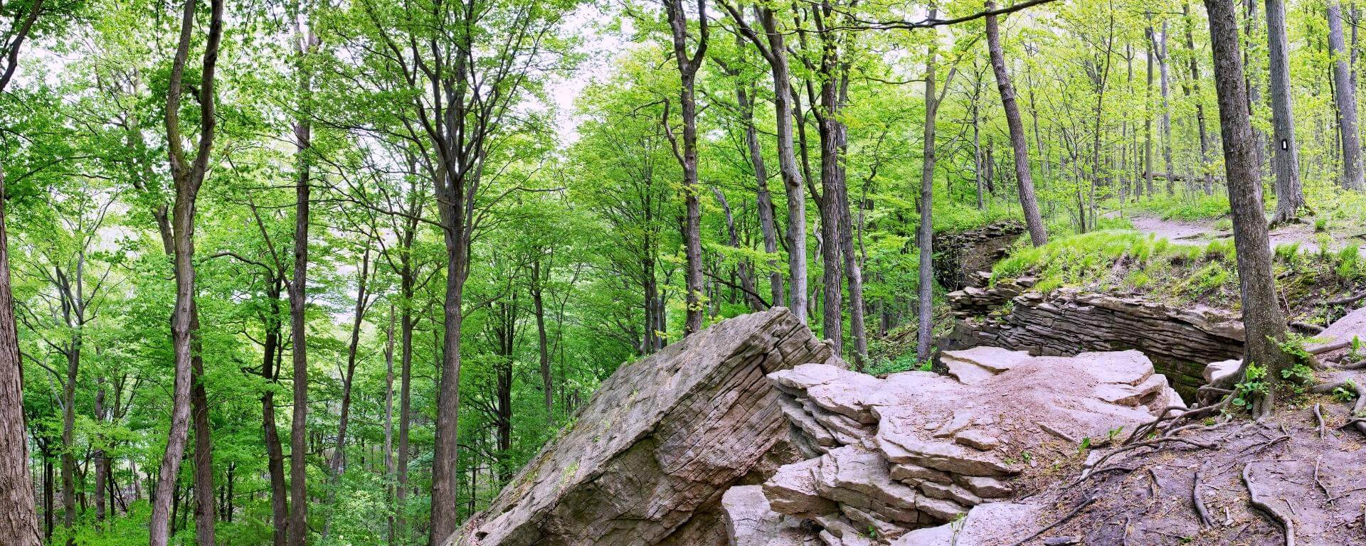
You can’t talk about the Bruce Trail without first understanding the reason for its existence: the Niagara Escarpment. For many of us who live in southern Ontario, the Niagara Escarpment is something we might take for granted — often associated with its famous namesake waterfall. But the Escarpment is actually a fascinating place that is home to not only the Bruce Trail, but to a whole host of diverse species of plants and animals. And its craggy rocks reveal the history of Ontario.
Here’s a very short version: North America sits on rocks created billions of years ago and these are known as Precambrian rock (the Canadian Shield) which are exposed in some areas of the province. Where it is not exposed, those billion-year-old rocks are covered with layers of Palaeozoic rocks, created by deposits from an ancient sea that covered this area about 400 million years ago. On top of that is Pleistocene sediments deposited during the glacial period about 3 million years ago.
What we identify now as the Niagara Escarpment is where that middle layer of Palaeozoic rocks is exposed and not covered up by layers of glacial sediment. Still with me?
The cool part is that 400 million years ago, the landscape looked different (think coral reefs and tropical seas) and those differences can be observed in the exposed rocks throughout the escarpment. This is a simplified explanation but you can find much more detail about the various rocks, sediments and fossils of the Niagara Escarpment on the Bruce Trail website.
Where does the Niagara Escarpment Start and End?
The rocky limestone shoreline of Georgian Bay viewed from the backcounty campsites located at Stormhaven in Bruce Peninsula National Park. Photo by Corbi Sharpe/Parks Canada
The Canadian section of the Niagara Escarpment runs from the Niagara River in almost a straight line west towards Hamilton, then it shoots north until it reaches Georgian Bay. From there, the Escarpment heads northwest, forming the spine of the Bruce Peninsula up to Tobermory. It then sinks beneath the waters of Lake Huron and reappears again to form parts of Manitoulin Island. On either end of the Canadian section, the Escarpment continues into the United States: New York State on the south end and Wisconsin in the northwest.
The Niagara Escarpment, from Niagara Falls up to the Bruce Peninsula, is a UNESCO World Biosphere Reserve thanks in large part to the conservation work of the volunteers that worked to create the Bruce Trail. Volunteers continue to run the Bruce Trail Organization and maintain the trail.
How to Read the Signage on the Bruce Trail
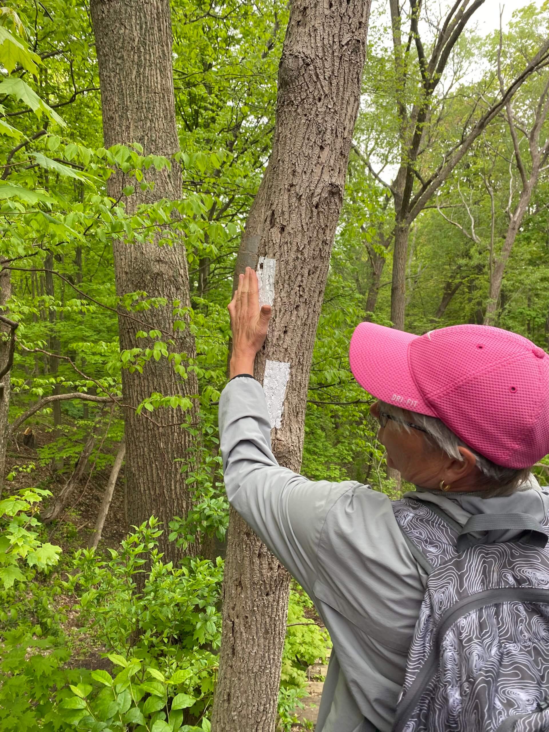
The Bruce Trail is recognized by white vertical rectangular marking, called blazes, that show the path. One white rectangle means the Bruce Trail continues straight ahead. Two white rectangles mean a few different things. If the upper rectangle is on the left, it means the trail veers to the left; if the upper rectangle is to the right, it means the trail veers to the right. If you see a top rectangle flipped horizontally to form a “T” shape, it means you’ve come to the end of the Bruce Trail (this would only be shown on the beginning and end of the entire Bruce Trail).
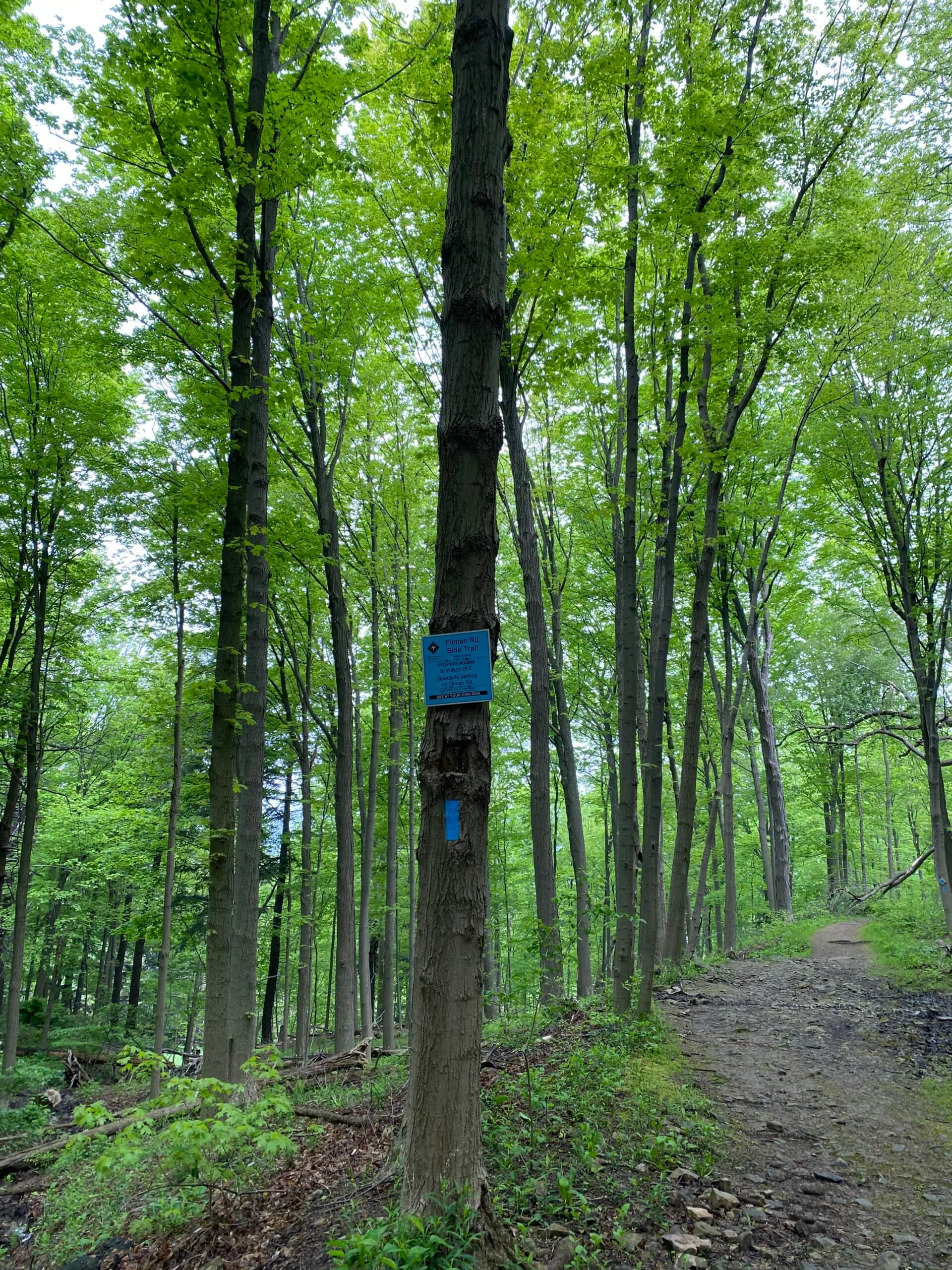
Blue rectangular markings represent side trails — of which there are more than 460 km! — and follow the same rules as the main trail markers. Here you will see a lot more of the “T” shape that represents a side trail coming to an end.
As some setions of the Bruce Trail go along private land (through agreements) please be respectful of signage and stay on marked trails only in these areas.
Sections of the Bruce Trail
The Bruce Trail is divided into nine sections. Starting from the tip of the Bruce Peninsula and working our way down to the Niagara region, we will break down each section below. The sections are maintained by volunteers in local trail clubs and we will provide a link to each club where you can gather more information on the particular section you’re interested in hiking. Keep in mind that camping is only available in very few designated areas around the trail so overnight hikers have to find local accommodations.
If you are interested in hiking a portion of the Bruce Trail but don’t know how to get started or if you’d like a more guided experience, take a look at Landsby’s 5-day Bruce Guided hike — all your accommodations, meals and transportation between trail/hotel are covered.
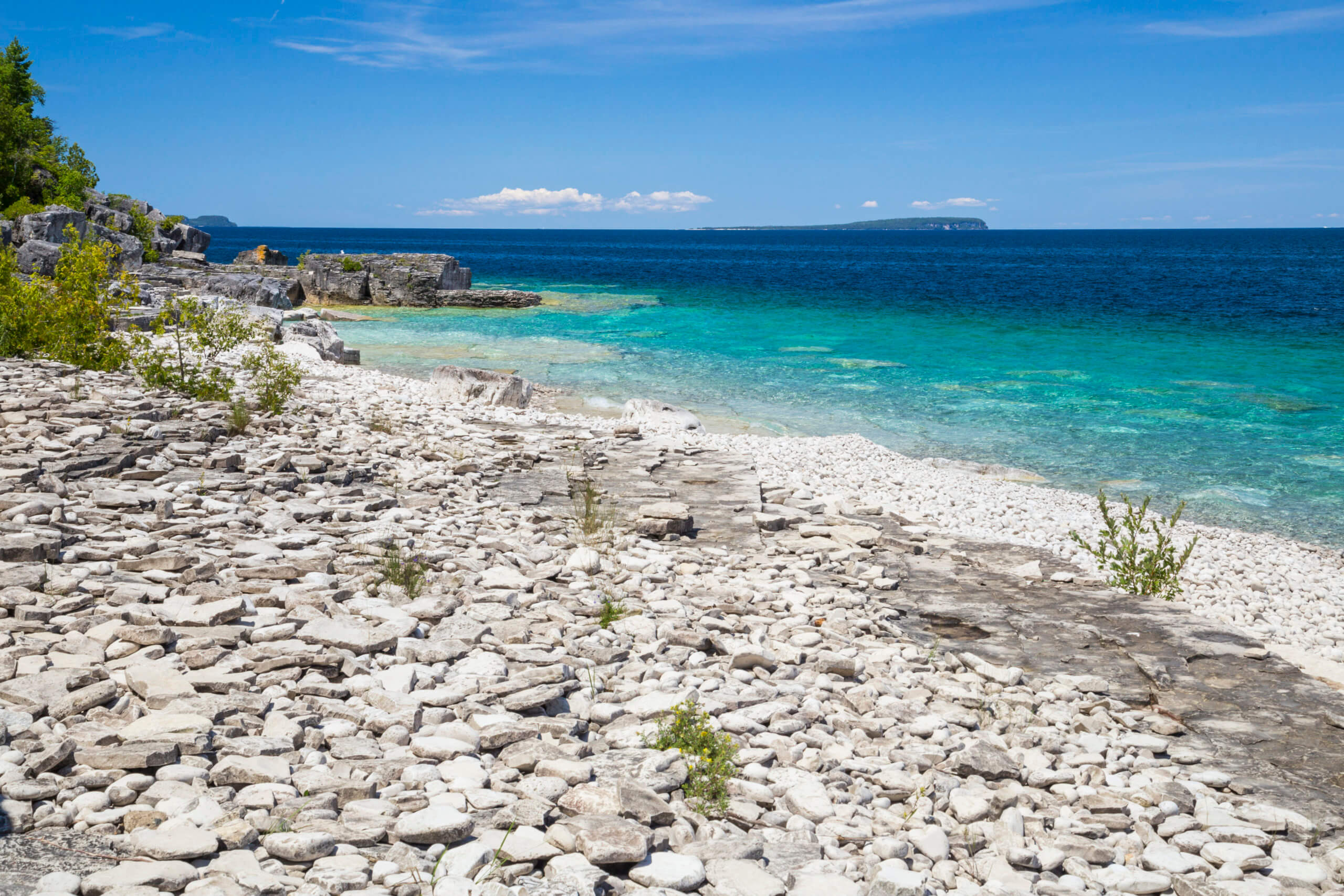
The Peninsula Section
From Tobermory to Wiarton, the Bruce Trail zigzags along the eastern edge of the Bruce Peninsula for 166 km. There are challenging sections of this trail and many are quite remote but hikers are rewarded with incredible vistas from towering cliffs that drop off into turquoise-coloured water.
The Peninsula Bruce Trail Club
The Sydenham Section
This section of the trail, which runs south from Wiarton until the hamlet of Blantyre (just west of Thornbury), is characterized by spectacular views of Georgian Bay. Along the 170-km route you will pass through forests and wetlands, past waterfalls and incredible lookouts. Inglis Falls is particularly scenic.
The Beaver Valley Section
Take in the dolostone cliffs, creeks and waterfalls in this section of the Bruce Trail. Heading southwest from Blantyre, the section does a deep “V” heading northeast towards Craigleith on the shores of Nottawasaga Bay. The section is a total of 117 km plus another 25 km in side trails. Hoggs Falls is a beautiful section to hike.
The Beaver Valley Bruce Trail Club
The Blue Mountains Section
As you would expect in the Blue Mountains section, the trail here has high bluffs and expansive views of the surrounding countryside. It goes from Craigleith down to the hamlet of Lavender for a total of 66 km of trails. A good section to check out is the Nottawasaga Bluffs, which has a good look out and some side trails for shorter hikes.
The Blue Mountains Bruce Trail Club
The Dufferin Hi-Land Section
Starting in Lavendar, this middle section of the Bruce Trail crosses shaded valleys and open meadows as it meanders through the Boyne Valley Provincial Park and Mono Cliffs Provincial Park before ending in the village of Mono Centre. Expect spectacular views, exposed limestone rocks and some steep elevation (1650 feet above sea level at one point).
The Dufferin Hi-Land Trail Club
The Caledon Hills Section
This popular section of the Bruce Trail stretches for 71 km from Mono Centre to Creditview Road through Caledon. For much of this stretch, the Escarpment is buried beneath glacial moraine deposits. The path follows through mature hardword forests and past wetlands. One of the most distinguishable features comes near the border with the Toronto section of the Trail and that is the Cheltenham Badlands, which are made up of iron-rich shale deposits from nearly 450 million years ago.
The Caledon Hills Bruce Trail Club
The Toronto Section
Although the surrounding area is becoming increasingly urban, the dense forests and rocky crevasses of the Toronto section of the Bruce Trail remain a beacon for nature lovers in the area. This section of the trail is 50 km long (with an additional 61 km of side trails) and goes from Creditview Road near Cheltenham to Milton. The trail winds through Scotsdale Farm, the Limehouse Conservation area and Hilton Falls.
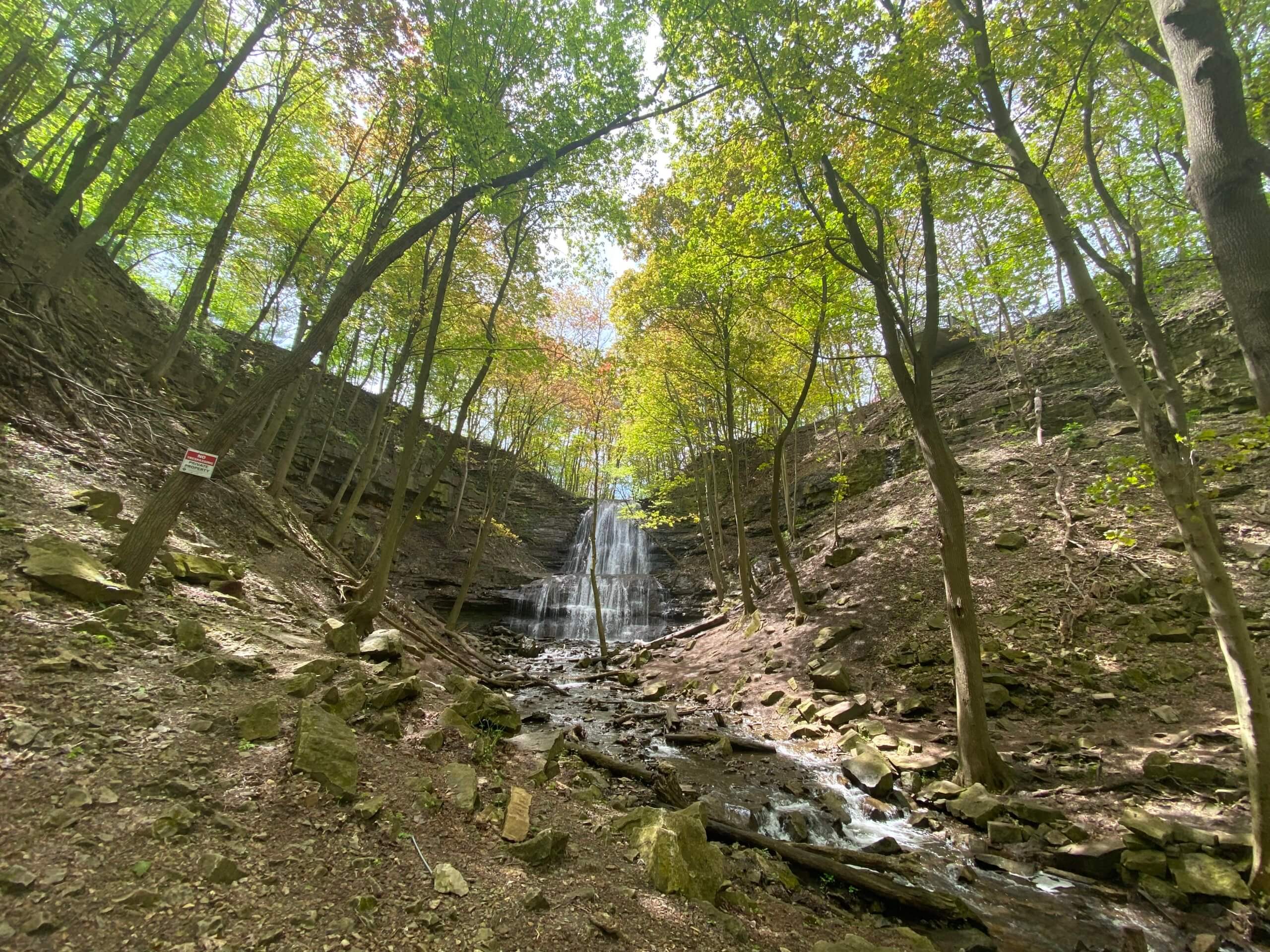
The Iroquoia Section
Known for its many waterfalls, the Iroquoia section of the Bruce Trail begins in Milton and heads down to Grimsby, following the ancient shoreline of Lake Iroquois. Some of the more known waterfalls in this section include Tiffany, Sherman and Webster’s. The trail also passes near a reconstructed 15th century Iroquoian village and a 24-metre deep meromictic lake (a lake that has layers of water that don’t intermix).
The Niagara Section
The last (or first) section of the Bruce Trail is the Niagara portion, which goes from Grimbsy to Queenston. The southern terminus is located in Queenston Heights Park near Niagara Falls, on the west side of a deep gorge. This section passes through woodlands, farmland and all four of the Welland Canals.
Pingback: The National Parks Of Georgian Bay - Landsby
Pingback: Exploring the Beauty of Niagara Falls | Landsby